
The quarries of Oricum (Albania – 2016)
Modern Albania withholds numerous forgotten archaeological treasures. One of them is the ancient city of Oricum, where a key event in Julius Caesar’s ascent to total domination took place. The communist era that isolated the country for most of the 20th century preserved this fascinating site until today, as archaeologists have only recently started their research.
History
Julius Caesar is arguably the most fascinating figure in History. The great strategist not only conquered Gaul but most of the Mediterranean world in just a few years, before he was betrayed and murdered.
Somewhere along his tumultuous life, a key episode in his ascent to total domination is lesser known by the public. It took place in 49 BC, and some historians don’t hesitate to qualify it as one of the most audacious military move of the general’s career.
When Gaul surrendered in 50 BC, Rome started seeing Caesar’s power as a threat. Following the custom, the Senate urged the general to scatter his troops. Caesar refused, and led his army across the Rubicon river in Northern Italy: civil war was declared. Most of the senators decided to flee with the help and protection of Caesar’s enemy, Pompey.
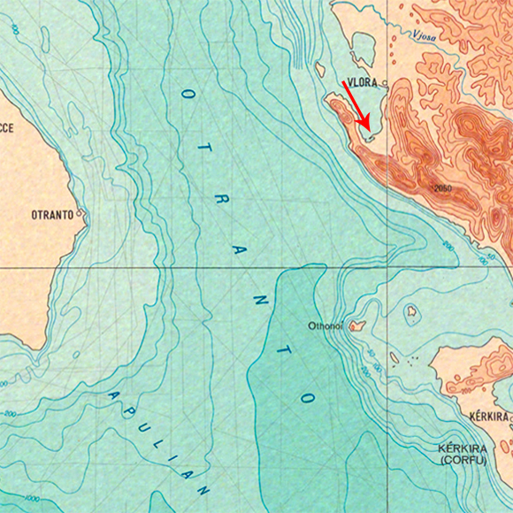
It took them a few days to take refuge on the other side of the Adriatic See, a territory then named Epirus which was controlled by Pompey’s army. As Caesar reached the port of Brindisi, he understood that a final battle would have to take place on the other side of the Adriatic. To succeed, he had to infiltrate the enemy’s territory.
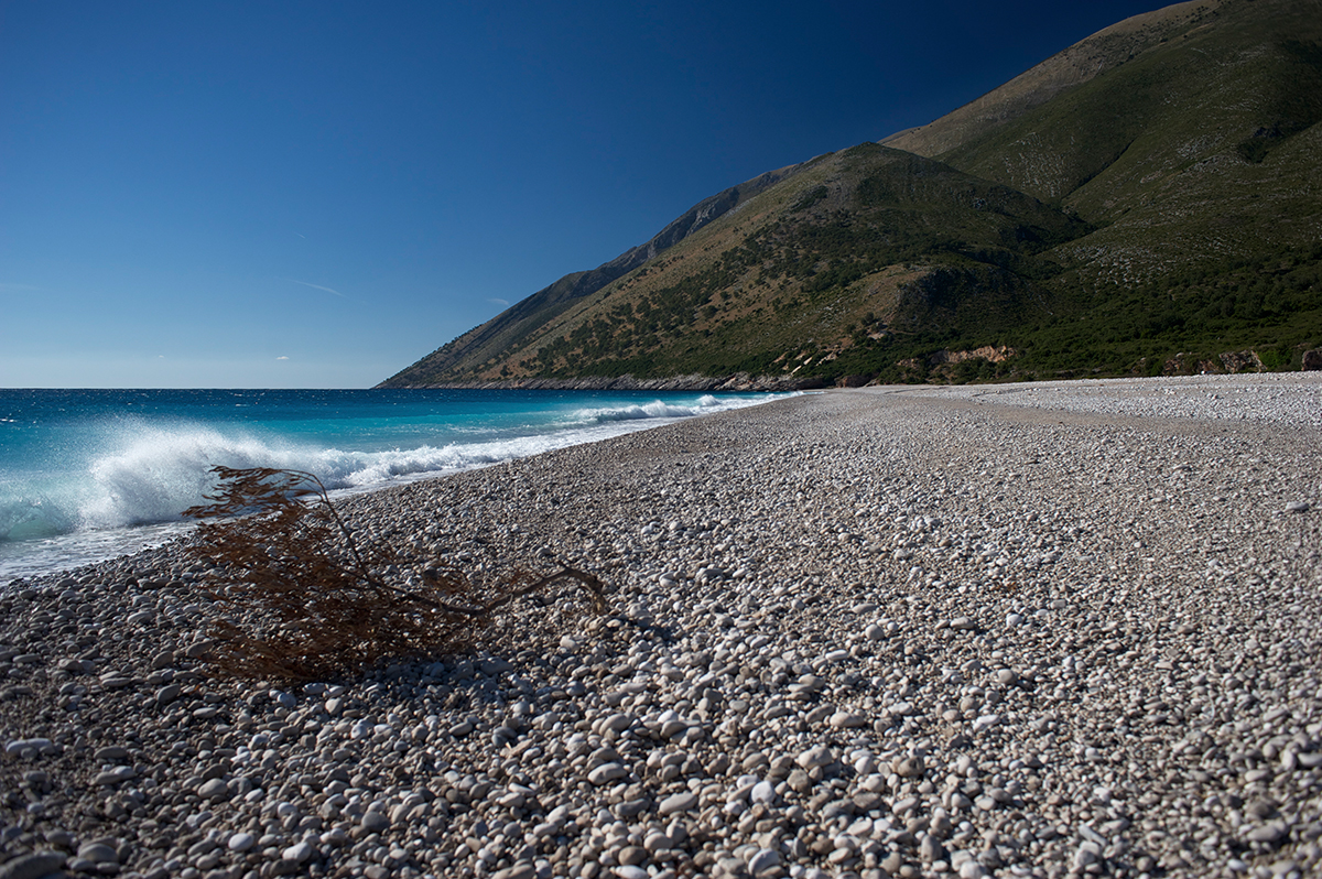
In the autumn of 49 BC, a season known for its fierce storms over the sea, Caesar crossed the Adriatic accompanied by his seven legions. Just before dawn, the twelve sailing galleys managed to reach the shore without being detected by the guards. After landing on a small beach shadowed by a mountain, the army climbed up a mountainous pass at 1000 meters above sea level, before storming down on the port city of Oricum. Taken by surprise because they were expecting troops to come by way of the sea, Pompey’s troops were overwhelmed in several land and naval battles. After a year of fighting, Caesar finally defeated his enemy’s army in Pharsalus, Macedonia.
Today
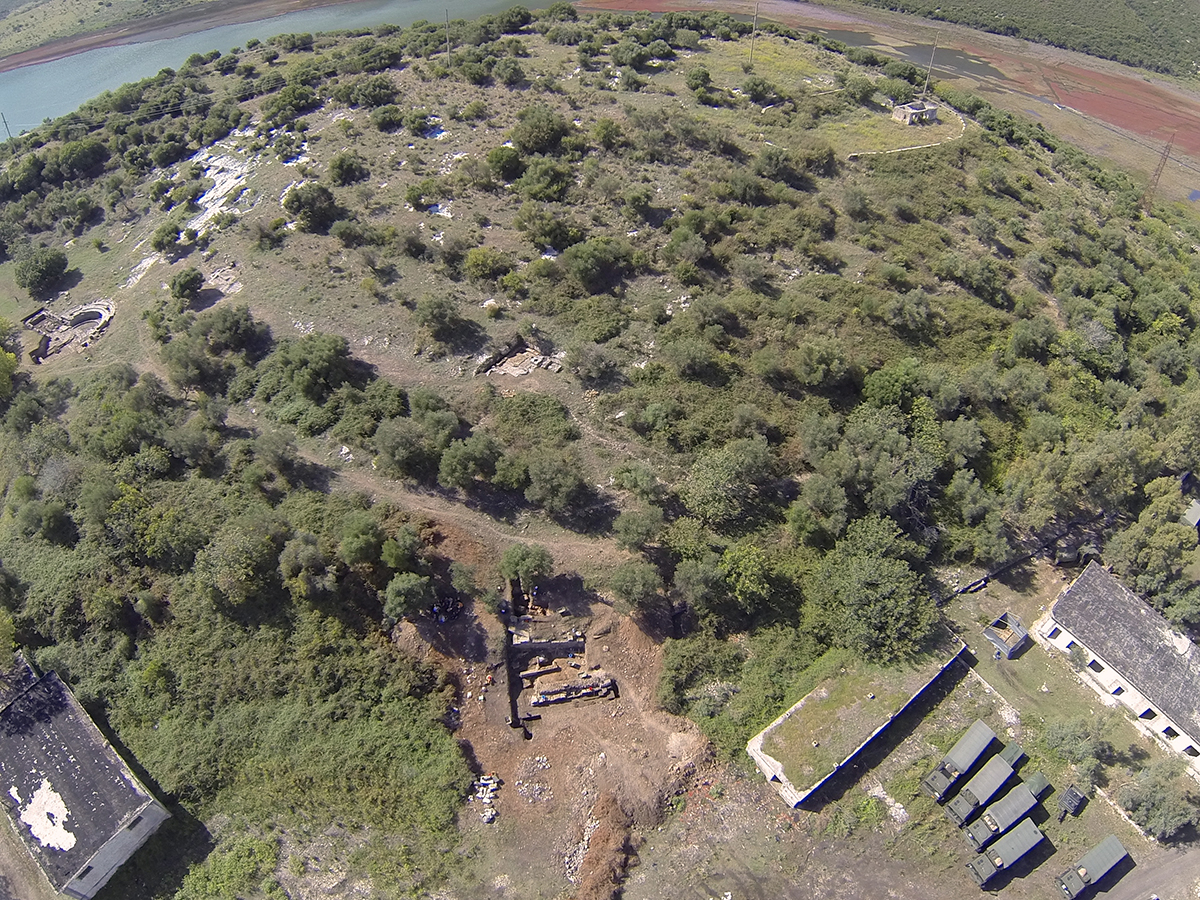
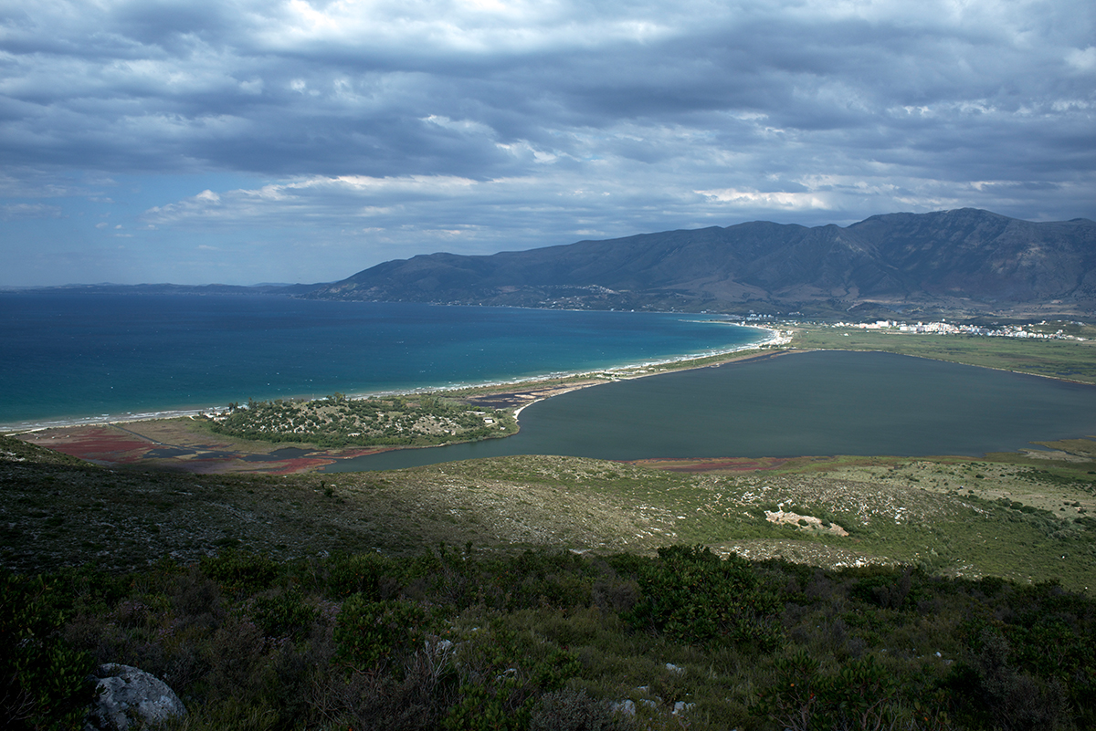
Important vestiges of this journey, told by Julius Caesar’s own hand in his “Commentaries on the Civil War”, are still visible to this day: Brindisi, which is an important port in the region of Apulia, the landing beach in Epirus, the road up to the mountain pass but most importantly: Oricum and its ancient harbour that seems lost in time.
Very few people have been able to follow in these important footsteps and excavate the exceptional site in Oricum. There is a simple explanation: most of ancient Epirus is part of today’s Albania. This small Balkan country was cut off from the rest of the world for the better part of the 20th century, isolated from foreign influences on the orders of one of the most repressive dictatorship in the communist era.
The fall of Communism in the 90’s opened the door to mass-scale corruption and wild opportunism. Both brought the country to bankruptcy in 1997. Still today, this UE neighboring country is considered “in development”. Basic infrastructure such as paved roads, running water and electrical network are still not available everywhere. Paradoxically, this dramatic situation allowed the preservation of one of the most important archaeological heritage in the Mediterranean basin: on land and underwater, an unimaginable treasure more than 2000 years old still remains to be thoroughly discovered and studied.
Location

Logistics support to the team of archaeologists
The Octopus Foundation decided to support the excavation project of Oricum in Albania, led by a team of archaeologists from the UNIGE (Swiss director Dr Jean Terrie and Albanian Dr Saïmir Shpuza). During the September 2016 mission, the crew of the Octopus Foundation assisted the terrestrial scientific study by providing detailed documentation on the marine and underwater area of the ancient city.
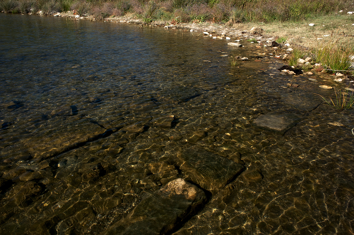
- The first objective is to look into the theory that the ancient city spread to a zone further from the fortification, in an area now partly covered by the lagoon.
- The second objective is to locate and map the different quarries in the Karaburun (fine white limestone), which might have been the main commercial activity of the ancient city.
- The last objective is the creation of a 3D model (above and under the surface) of the main stone quarry, including a zone that has been submerged by the rising of the sea level.
Media for the public
Along with the direct support, the Octopus Foundation wishes to finance a series of media the will allow the public to better understand this important archaeological site in modern Albania. These media will help bring all the light on the day to day life that took place in this ancient port city, and on the troubling times that saw the battle between Caesar and Pompey put a term to the Roman civil war.
Video in French:
Location
3D modeling
The archeologists of the University of Geneva and the Albanian Institute asked the Octopus Foundation to search in the sea and the lagoon surrounding the forgotten city for ancient structures. After the 2016 mission, the Octopus Foundation is proud to present a model of the ancient quarries. The cutting of stone was probably the city’s main activity. The perfectly white limestone of the Karaburun peninsula was used by the stonecutter in Rome. This multi-layer 3D model highlights a part of the coast that was excavated by the craftsmen of the time.
After clicking on the “play” symbol, and once the buffering is completed, it’s possible to click anywhere in the window and drag the pointer in any direction. It is also possible to zoom in or out, by pressing and maintaining the “shift” button.
With a free and simple tool, the Octopus Foundation is able to bring anyone on location, as if they accompanied us on mission. There is no need for special knowledge or expertise in the marine world to wander these two important spots, such as the forgotten city that was built on a hill:
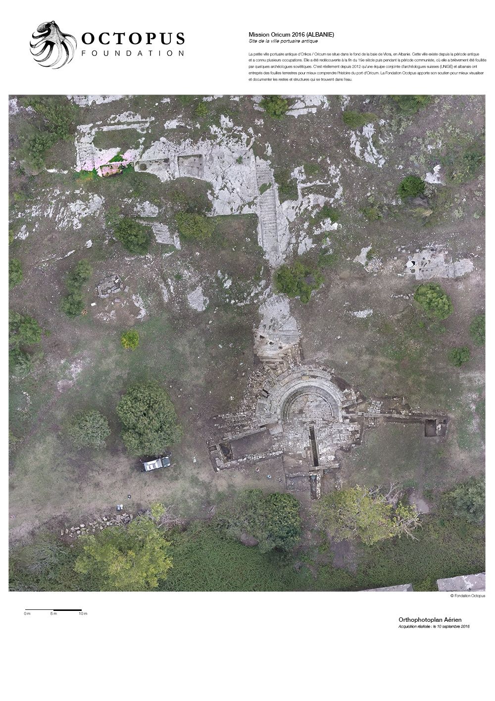
Orthophotoplan
From the 3D modeling which is a simple visualization element, the computer program can also create a scientific tool: the orthophotoplan. From a vertical projection of the whole of the relief on a horizontal plan, this precise map respects all the real scales.
Comic strip
Because the Octopus Foundation’s wish is to bring awareness to a public of all ages, we will be telling our projects through comic strips. The Foundation’s crew is not only composed of divers, sailors, journalists, biologists and historians, but we are also lucky to have Antoine Bugeon, a young and talented designer who happens to be an experienced sailor.
We asked him to draw what happened behind the scenes of the Oricum-2016 expedition, so that the reader can understand the importance of this historical site.
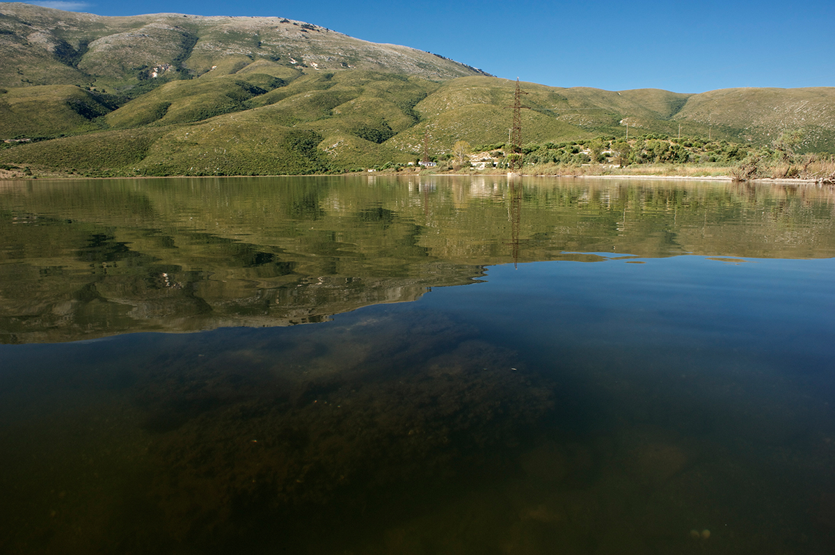
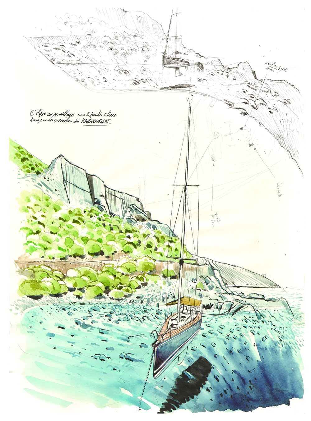
Here is a view of what we saw during our sailing expedition. Antoine, managed to depict how impressive the Albanian mountains are, and how they literally fall in the sea. On the top side, Porto Palermo anchorage, last shelter before Orikum. Drawing by Antoine Bugeon.

Scientific study
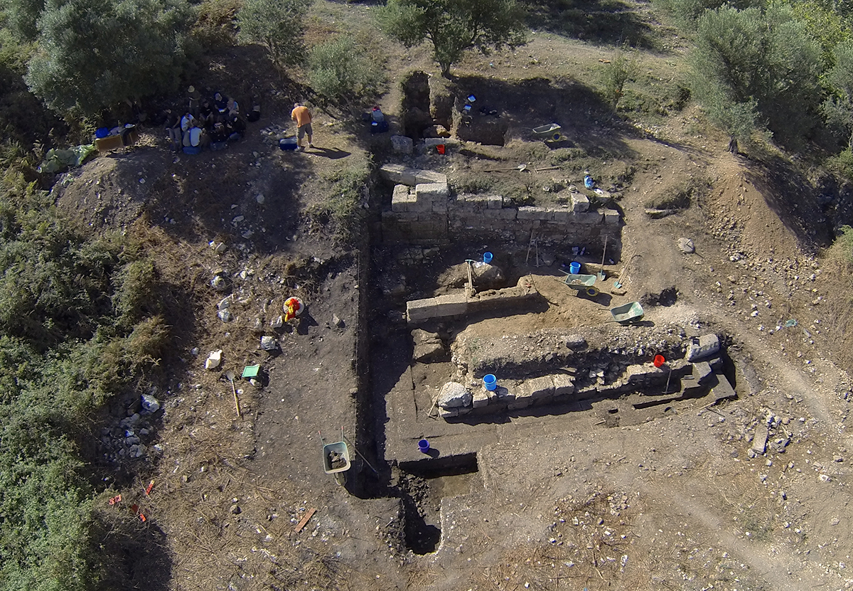
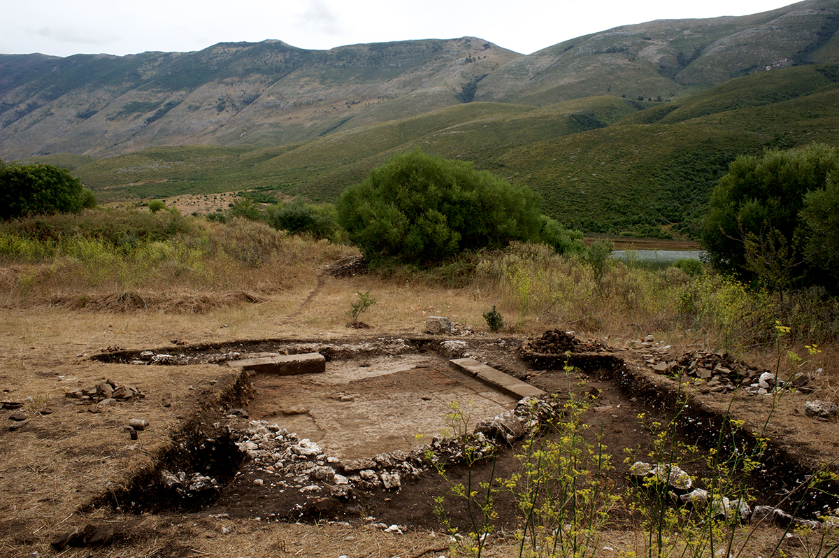
In 2005, archaeologists from the Geneva University in Switzerland (UNIGE) discovered for the first time the almost intact remains of ancient Oricum. Indeed, most of the site was surrounded by the Albanian military complex of Pasha Liman. Unbeknownst to the military, their off-limits area protected the precious site from depredation.

In 2008 and 2009, the Swiss team dug trenches and marked the archaeological zone. The results exceeded their expectations, thus enabling them to prospect further excavations.
Between 2012 and 2014, a Swiss and Albanian team conducted three series of about one-month-long excavations. Major discoveries were revealed, such as a monumental fountain, an important public structure, an intact infant’s tomb next to the ancient city, and one of the gates in the city’s wall.
> Links to a video documentary, in English, produced and directed by OCEAN71 Magazine (Season 1 / Season 2)
At the end of April 2016, the archaeologists received further funds to follow up on their field research.
Location
Team members

Julien PFYFFER
Founder and chairman
Ariel Fuchs
International advisor

Philippe HENRY
Director of Photography

Sebastien ROUSSEAU
Navigation manager
Antoine BUGEON
Cartoonist and sailor
Christophe VIGNAUX
Diver and skipper
Margaux CHALAS
Sailor and stewardship
Guillaume HENCHOZ
Reporter and historian
Partners

UNIGE
The University of Geneva

OpenRov
Technology partner
Gallery