Bristol Beaufighter (Greece – 2015)
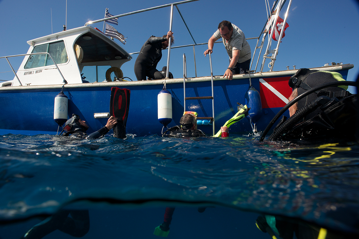
For the pilot project, the Octopus Foundation chose to study the zone where a British fighter plane was shot down by the German artillery on the 19th of July 1944. To look into the underwater area next to the coast of Cephalonia, in Greece, the crew used many different techniques. Today, the end result is that anybody can follow us deep underwater to understand what really happened that day.
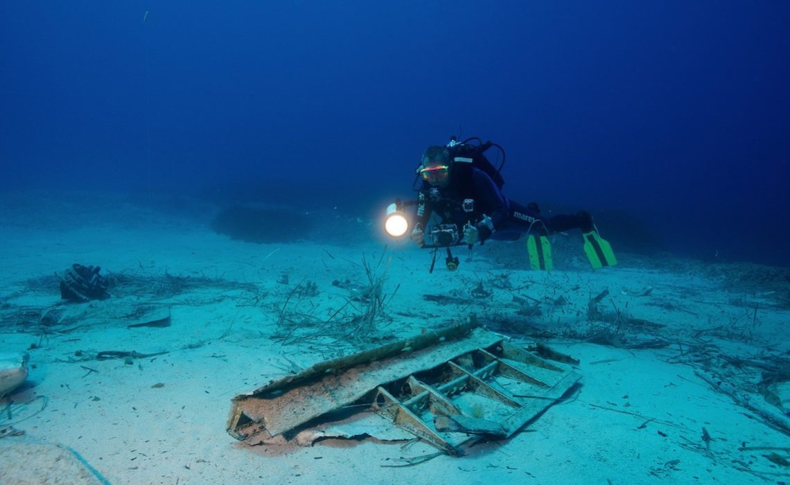
Off the coast of Cephalonia, a Greek island, we discovered the remains of an English fighter jet dating back to the Second World War, peacefully resting at a depth of 17 meters below the surface. The few scattered pieces of fuselage are all that remain of an incredible war episode.
This story starts with 26-year-old Sergeant Harold Yorke, fighter jet pilot in the British army. Soon after D-Day in Normandy, and along many others of his age, his mission was to put pressure on the German army in the South of Europe. At that time, stopping Hitler from moving his troops towards the North, where the allies were already struggling, was matter of life and death. Therefore, English planes were taking off every day from the bases in Egypt and Libya to attack the German strongholds on the northern coast of the Mediterranean.
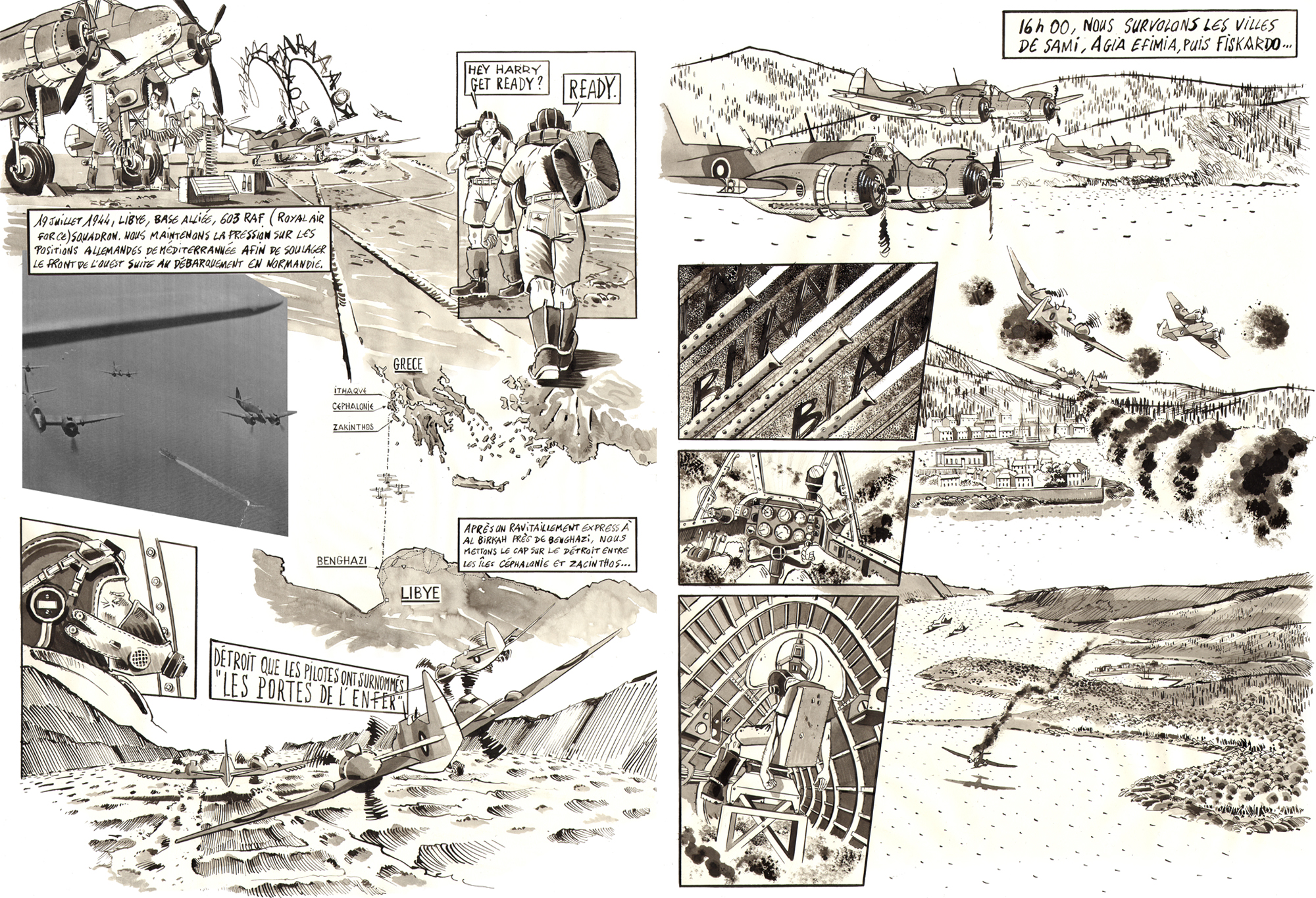
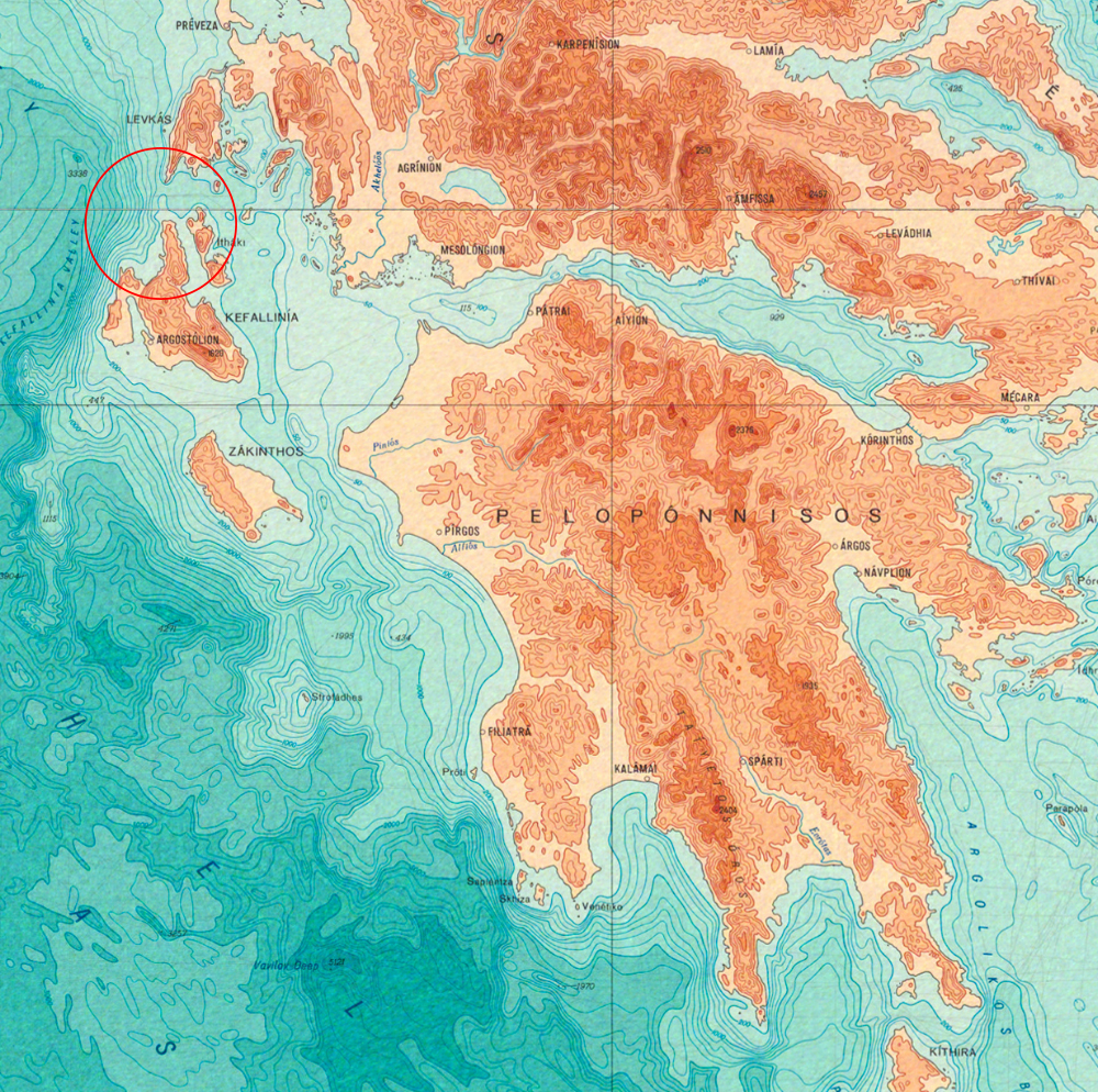
On the 19th of July 1944, a squadron of three planes known as Bristol Beaufighters left Libya and headed straight to the enemy positions in the Ionian Islands, in Greece. They were flying low, and entered what they referred as “the gate to hell”, the straight between Cephalonia and Ithaca.
They almost made it to Fiskardo’s port unscathed, at the northern tip of Cephalonia, but the three planes were suddenly being fired at from anti-aircraft artillery on the ground. Harold’s plane received a spray of bullets, and Jack Shaw, the co-pilot sitting right behind him, was killed instantly. Wounded and trying to keep control of a half-burning plane, Harold was able to land on the water, and exit the cabin before it sank.

Harry was later arrested by the German military, as soon as he reached dry ground. He would later witness firsthand the nightmare of deportation through Central Europe. At the end of the war, he was liberated.
Incredibly, Harry wrote his story on a few pieces of toilet paper, and managed to keep them through the entire ordeal. He gave his journal to his wife and daughter once back home after the war. He died in 2001 in England. Cédric Georges was able to track down Harry’s family, and meet the daughters of the pilot in London. They gave us the permission to tell this extraordinary story.
Location

Can we show the underwater world to a public that doesn’t necessarily have marine knowledge? Such was the question that kept us awake at Octopus Foundation, since the beginning in 2015.

Whether it is in the fields of marine biology or underwater archaeology, the Octopus Foundation’s ultimate goal is to inform the public with a knowledge that was once reserved to an elite group of specialists, scientists, oceanographers, and sometimes aficionados of the sailing and scuba diving world.
The Foundation’s ambition is to take you out at sea with us, so that anybody ca dive in the depths to observe the underwater wonders, alive or historical.
As a pilot project, we chose an underwater site just a few meters off the coast of the Greek island of Cephalonia. With the help of the French diver Cédric Georges, we discovered the remains of an English fighter jet dating back to the Second World War, peacefully resting at a depth of 17 meters below the surface. The few scattered pieces of fuselage are all that remain of an incredible war episode. We were able to uncover the story behind the wreck, and here it is.
Method
With this mission, the Octopus Foundation experimented the documentation of an underwater area with various techniques; in this case, the seafloor where pieces of the plane’s fuselage were resting. The aim in the future is to use the same documenting techniques with archaeological or biological underwater projects.

In the next tab (Technology), you will find the techniques that were used or developed for the “Bristol Beaufighter” project.
Location
Here are the tools that were used or developed for the “Bristol Beaufighter” project:
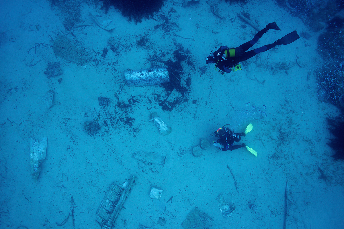
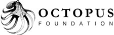
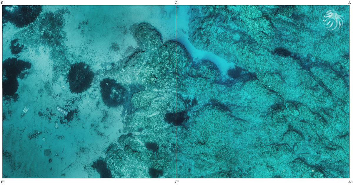
1) Map of the sea floor
Maps are essential for marine expeditions. In this case, the interest zone was under the surface. We decided to create a precise map of the sea floor that would give us important information on the surroundings.
Our sailing boat is equipped with a sonar, and we used it to scan the plane’s crash zone. After many hours of crisscrossing the area, our tool was able to generate this useful map (measured in meters).

With the information we were able to gather from Harold’s journal, we learned that while he was dramatically loosing altitude, he narrowly missed the rocky point situated at the bottom hand side of the satellite photo. He wrote that he managed to land the plane in the water, and miraculously get out before it sank to the bottom.
With the help of local knowledge, we learnt that the plane sank and the wreck was later discovered by a fisherman. Later, the local population used the fisherman’s net to pull the fuselage closer to shore, most likely to where the debris still lie today. In dire need of any kind of metal, the locals decided to dynamite the wreck in order to gather smaller pieces of aluminum. This was confirmed when an old lady showed us a cooking pot that was made from the very pieces of the plane.

The real crash zone is likely to be in the depth zone indicated by the yellow to orange colors on the above map, which corresponds to 30 to 40 meters under the surface of the Mediterranean Sea. If the plane had crashed a little further in the blue zone (more than 70 meters deep), the local population would have found it much more difficult and even impossible to pull the 10-ton-wreck back.
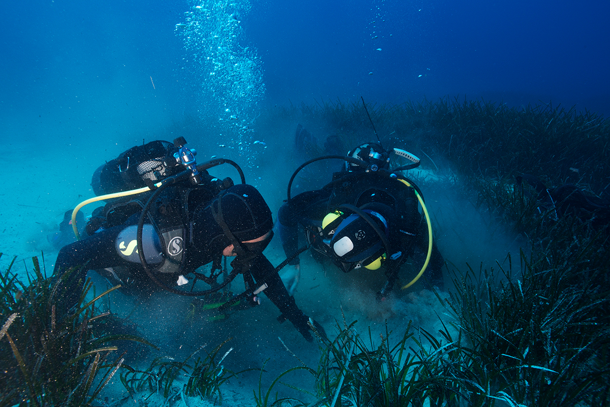
2) Marking of the debris’ zone
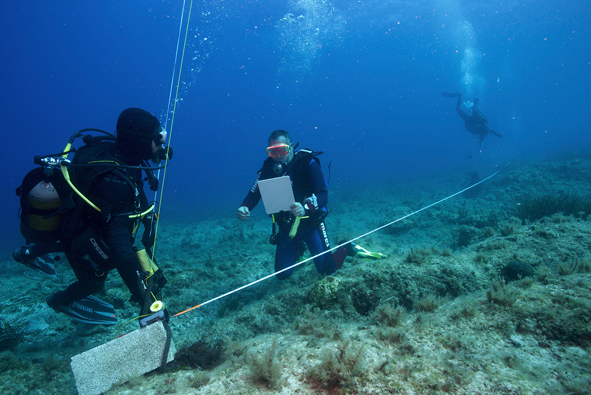
Once the map was available, we decided to delimit a working space around the plane’s debris. It was important to mark out the zone without disturbing the environment.
We started by delimiting a square area of 20 meters on each side, but we forgot that visual references are different in the water. At first, we made the mistake of relying on our eyesight and came up with a 20-meters-sides’ diamond. In order to rectify the angles’ problem, we used diagonals that have to be perpendicular and the same length.
 Once familiar with the process, we tried it on a more complex zone, where a rocky slop heads back up towards the surface.
We finished delimiting a global zone of 20 meters by 40 meters, which adds up to 800 square meters. In order to facilitate the photographer’s work, we placed several buoys on the corners of our underwater squares as well as intermediary references every 5 meters.
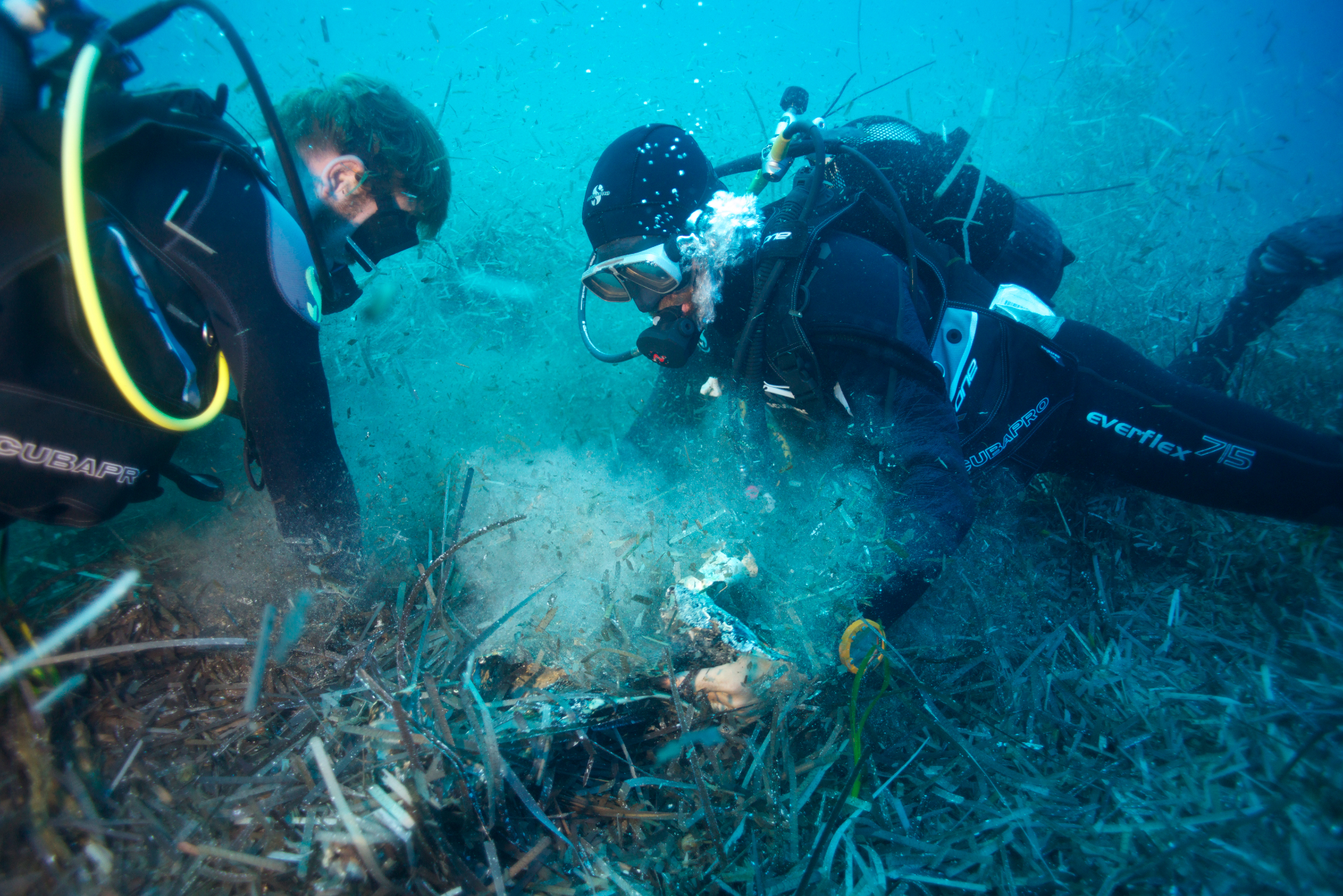
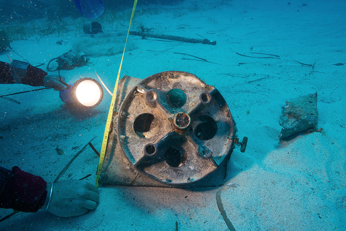
3) Photographic acquisition
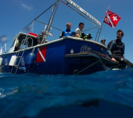
Once the area was properly defined, on the sea floor as well as on the surface, Philippe Henry, the crew’s chief photographer, started systematically crisscrossing the first square. 120 photos were necessary, and it took him 20 minutes.
For information, we used a Nikon D800 with a Nikon 20mm lens for this operation. Obviously, the equipment was tightly concealed in a waterproof case, from Ikelite.
Location
After capturing hundreds of photos and various information, here are the results of the “Bristol Beaufighter” project:
1) 3D modeling
Once the photos had been taken, we could start the computer processing. The end result was the first square displayed in three dimensions.
Later, Philippe went in the water a second time to photograph the whole area. With all these images, the computer created the sea floor in three dimensions.
After clicking on the “play” symbol, and once the buffering is completed, it’s possible to click anywhere in the window and drag the pointer in any direction. It is also possible to zoom in or out, by pressing and maintaining the “shift” button.
With a free and simple tool, the Octopus Foundation is able to bring anyone on location, as if they accompanied us on mission. There is no need for special knowledge or expertise in the marine world to wander this piece of sea floor and look at interesting objects. Such as the wing of the plane:
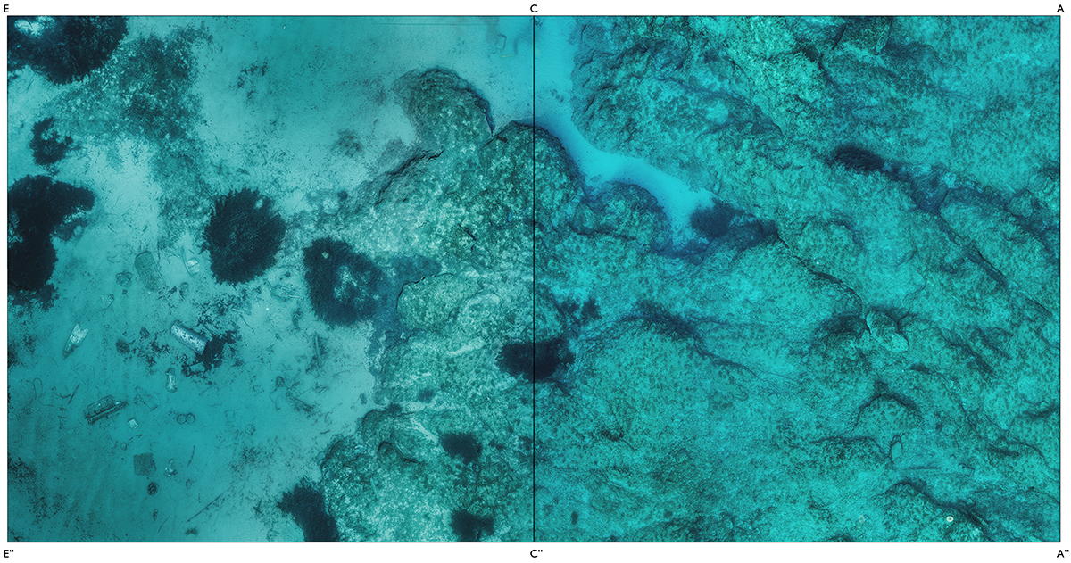
2) Orthophotoplan
Whether it is for the public or for scuba diving enthusiasts, these models are efficient visualizing tools of the underwater world. But are they really useful to scientists? One of the main objectives of the Octopus Foundation is to help scientific research and the exploration of the subaquatic world.
From the 3D modeling which is a simple visualization element, the computer program can also create a scientific tool: the orthophotoplan. From a vertical projection of the whole of the relief on a horizontal plan, this precise map respects all the real scales. While an underwater dive is limited by the amount of air a tank can hold, it is now possible to “bring the underwater zone to the surface” so that it can be analyzed on land.
3) Printed model
Finally, to complete this whole range of tools that are useful to the public and to scientists, we decided to build the model of the seafloor. It can now be used to explain the scientific project in a museum or in public exposition for example.
To render as many details as possible, we used the latest technology in the numeric printing world: 3D laser printing.
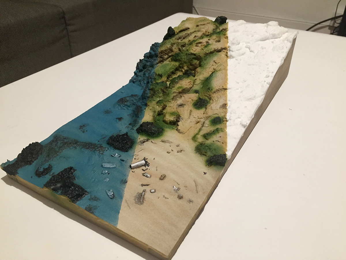
To create a 20 centimeter by 40 centimeter model, no less than 48 hours of printing were necessary. The result largely exceeded our expectations. With a 1/100 scale, every little stone, every irregularity in the rock can be seen with a naked eye. Even the ripples in the sand cannot be mistaken.
The model gets even more lifelike once it is painted. For this first project, we decided to show the three different stages. In white is the raw material. In the center, the surface floor is painted without the water. And finally on the left is the representation of what a scuba diver would see.
We imagine that such models could show the evolution of an underwater zone, such as corals that withstood a massive jump in temperatures. They could also enable the public to witness the different stages of underwater archaeological diggings on an ancient wreck for example.
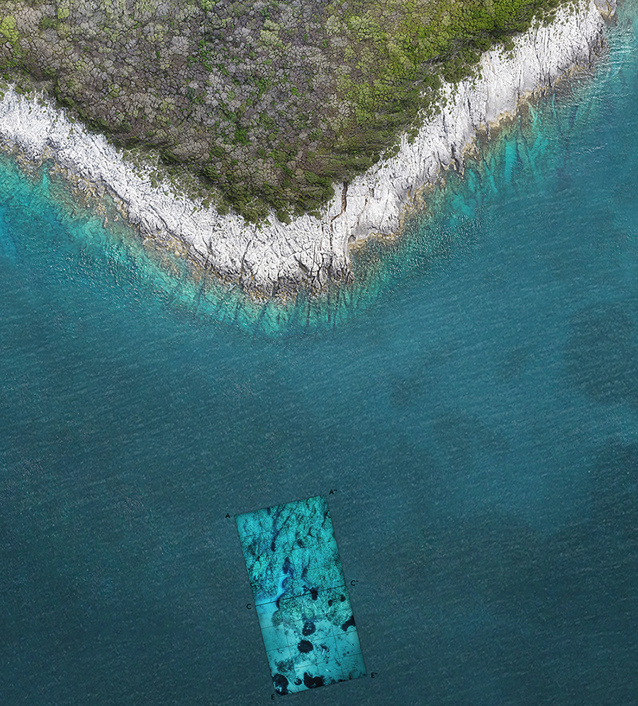
4) Window in the sea
What better way to familiarize the public with the underwater world than to show what is invisible? To answer this question, we invented the concept of “windows in the sea”.
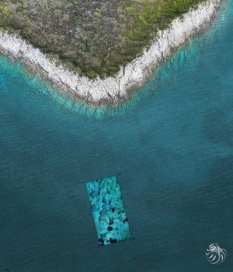
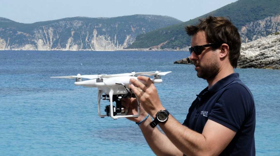
With the help of our aerial drone, we took photos of the coast. By using the buoys on the surface to delimit our zone, we could then incorporate the orthophotoplan.
From the land, the sea can change color and go from blue to green or even white to black. For mankind, it has always been a vast expanse of moving impenetrability.
The Octopus Foundation will multiply these windows in the sea, so that everybody can admire the underwater wonders and get in touch with a world that is still today feared and unknown.
5) Reconstruction clip
To add to this range of scientific tools and vulgarization media, the crew at Octopus Foundation decided to test the limits of what we could learn from the information in Harold Yorke’s journal. We wanted to recreate an accurate video of the crash.
The aerial drone is once again put to use, and we followed the Beaufighter’s path, from the moment it was hit but the German bullets, then flying over Fiskardo’s port until the emergency landing in the bay of Kamilia. Secondly, we animated a 3D plane in the flight’s video.
As said earlier for other tools, such a video could be displayed during an exposition or a conference, or could be part of a documentary.
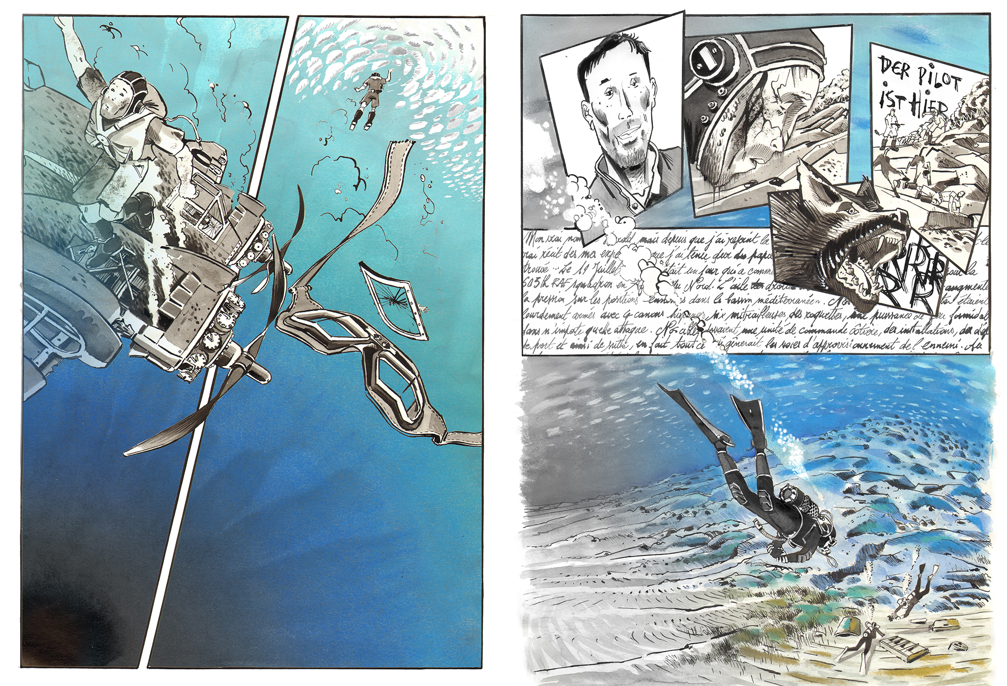
6) Comic strip
Because the Octopus Foundation’s wish is to bring awareness to a public of all ages, we will be telling our projects through comic strips. The Foundation’s crew is not only composed of divers, sailors, journalists, biologists and historians, but we are also lucky to have Antoine Bugeon, a young and talented designer who happens to be an experienced sailor.
We asked him to draw what happened behind the scenes of the “Bristol Beaufighter” expedition, so that the reader can understand the historical moment Harod Yorke lived close to Fiskardo’s port. With his sensibility, Antoine drew an incredible comic book of about 60 pages that will surely be thrilling to read for a young public.
Let’s not forget that the exploration has only begun. The discoveries that the scientists, journalists and sailors will make with the help of the Octopus Foundation are a gift for the future generations. With the generosity of our contributors, we will all help to build this universal knowledge.
Location
Thanks to the information gathered in Harold Yorke’s notebook, the pilot of the Bristol Beaufighter, we were able to retrace the last seconds before his crash in 1944.
Location
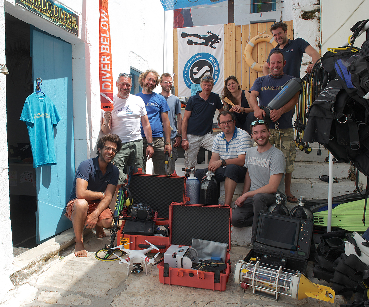
Team members
Julien PFYFFER
Founder and chairman
Ariel Fuchs
International advisor

Sebastien ROUSSEAU
Navigation manager
Philippe HENRY
Director of Photography
Fabien MADORE
Technology
Antoine BUGEON
Cartoonist and sailor
Christophe VIGNAUX
Diver and skipper
Margaux CHALAS
Sailor and stewardship

Charles VENAYRE
Architect

Cédric GEORGES
Diving instructor
Jesus ABAD LOPEZ
Scientific diver
Partners
Fiskardo Divers
Diving center
Inform
In this section, you can freely download this mission’s pictures and documents. Contact us if you need one or several high definition pictures.
IMPORTANT: You can use these documents for free if they are part of an informative or educational project. These media cannot be used in any commercial project. For each media used, please add the following copyright : © Octopus Foundation
Gallery