
The Island of Mozambique is a tiny piece of land of 1.5 km2, surrounded by the Indian Ocean. Yet, it’s size didn’t prevent it to become, during the 15th century, Portugal’s first and most important settlement on the East coast of Africa. For many centuries, its strategic location proved to be useful to countless Portuguese ships as their main refuelling stop on their way towards India and the rest of Asia. As a result of this rich past, dozens of boats have wrecked in the bay surrounding the island. Remains of around thirty vessels dated back to the 15th through the 19th century have been catalogues by Dr Ricardo Duarte, conventional archaeology and underwater archaeology professor at the Eduardo Mondlane University in Maputo, the capital of Mozambique.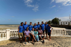
In order to support Dr Duarte’s project as well as help with the creation of a center for underwater archaeology on the Island of Mozambique, the Octopus Foundation team traveled to Sub- Saharan Africa between the 1st and 19th of July of 2018. The primary goal was to assist local archaeologists with specific tools and marine expertise. As a result, maps, 3D models of different sites, aerial and underwater photos, drawings of historical reconstructions and videos were created. All of this media will not only be useful to teach students in the archaeological center, but will also be displayed to a European public in an outreach effort.
After two weeks of field mission, here is a compilation of the work done by the Octopus Foundation’s team:
- High definition bathymetric map, created with a portable sonar. This map helps visualise the depth variations which create underwater currents. It is also useful in the preparation of future dives.
- Underwater 3D models of several shipwrecks. One of the sites was between 4 and 6 meters deep, and most probably the wrecking spot of a precolonial vessel. The second studied wreck was of a Portuguese carrack built during the 15th century, whose remains are now between 6 and 25 meters deep. A much more complex wreck to study. In the vicinity, a canon was dug out of the sand. Thanks to the inscriptions found on this piece of artillery, it was possible to determine how old the wreck was.
- Aerial 3D models of the bay, which help better visualise the wreck’s environment and thus better prepare future study sites.
- Mixed orthophotoplan, composed of an underwater plan and an aerial one. A tool that helps better visualise the underwater archaeological site.
- Photographs. Through them, the team tries to tell a story about the island, its inhabitant and their daily lives. This series of photos might one day be part of an exposition depicting this exceptional place.
- 52-minute long documentary, filmed and edited by Thomas Delors, the video specialist of the Octopus Foundation. Ordered by the French television channel France Ô, this film will be broadcasted prime-time on a Sunday evening. Stay tuned!
- Graphic novel. Following Dr Duarte’s wishes, Antoine Bugeon, the Octopus Foundation’s artist, drew several historical reconstructions of different era of naval importance which were witnessed by the Island of Mozambique.