Prehistoric villages in Geneva (Switzerland, 2022)
5000 years ago, men built wooden villages on the shores of alpine lakes. These “pile-dwellings” were eventually abandoned, their remains quickly covered by sediments deposited by rising water levels. Isolated from the air, fragile material such as wood has remained intact, representing an incredible source of information on the way our very distant ancestors lived. Today, some archaeological sites could be threatened by the joint effects of natural erosion and human activities.
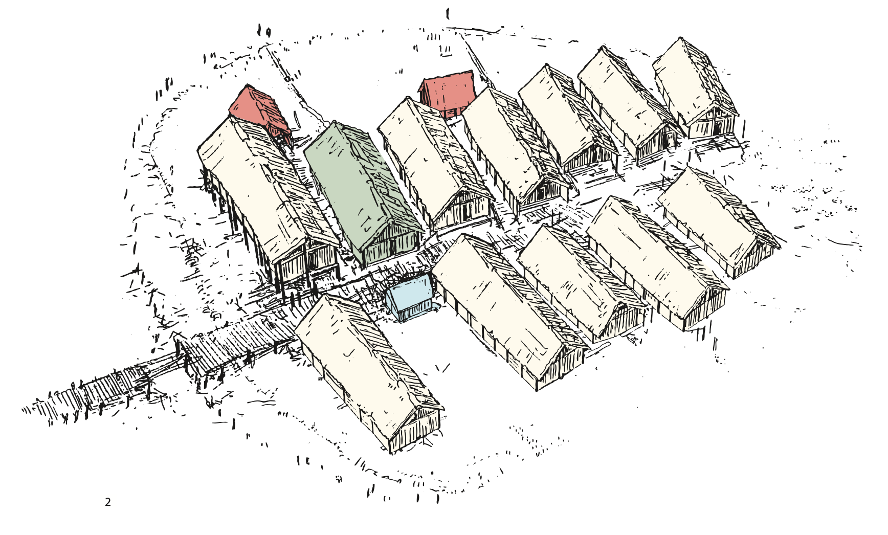
Who could imagine that a few meters below the surface, right next to the crowded streets of Geneva, the remains of several Neolithic and Bronze Age villages have lain intact for almost 5000 years for some of the oldest? These pile-dwelling villages (or stilt houses) were built by the first farmers of Central Europe. The sediments of the waters of the alpine lakes quickly covered the villages after they were abandoned. The remains were thus protected from the air and organisms that could have degraded them or caused them to disappear. Today, wood, fabrics, food, stone or bronze tools are still remarkably preserved in these veritable time capsules that are our lakes.
No other place on the planet offers such an explicit vision of the evolution of Neolithic and Bronze Age village communities. The remains of these habitats are our main source of information on the agrarian societies of prehistoric Europe.
Experts have listed our distant ancestor’s pile-dwellings in the lakes of all the countries bordering the Alps, in Switzerland, Germany, Austria, Slovenia, Italy and France. The 111 most important and best preserved villages still today were classified by UNESCO as World Heritage in 2011, as a unique object to be protected at all costs. This classification implies that it is up to each of the six countries to put in place precise tools to measure over time the evolution of the layer of protection that rests on each of these villages. Based on this information, archaeologists must take all necessary protective measures, without excavations, for future generations.
 It is in this context that the cantonal department of archaeology of Geneva called on the Octopus Foundation in 2021. With its marine and lake technical expertise, the Octopus team will support archaeologists to complete an updated inventory of the six lakeside villages in Geneva (three of which are classified by UNESCO), followed by a documentation on the current situation of each of the sites. The aim is to set up measurement tools that are able to monitor over the years the evolution of the sedimentary layer.
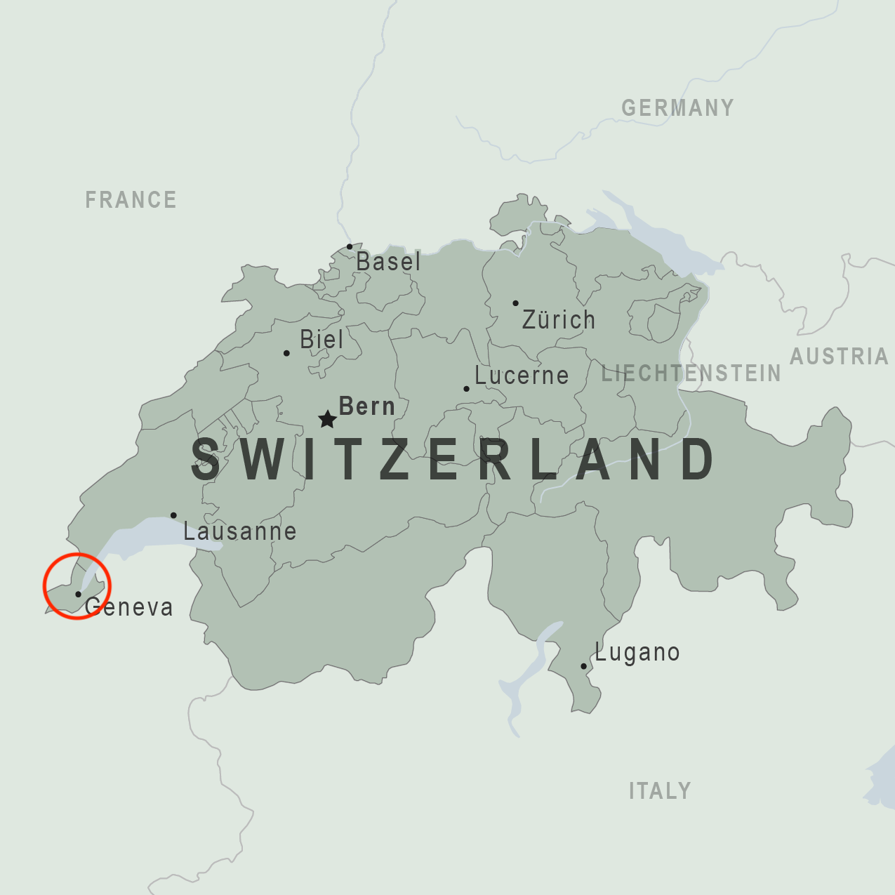
Location
After the archaeological study in 2019 and 2020 of the three wrecks discovered in Lake Neuchâtel, the Foundation’s team is preparing to dive back into the waters of the Swiss lakes. In July 2021, the cantonal archaeologist of Geneva, Nathan Badoud, called on the Octopus Foundation to document a precise inventory of the various sites, and to install the tools allowing a monitoring over the medium and long term. The recorded data should informs the specialists on the state of the layer of sedimentation. Is it thick and stable enough to protect the villages, or is it thinning to the point that it would be necessary to deploy additional protection to preserve the archaeological remains ?
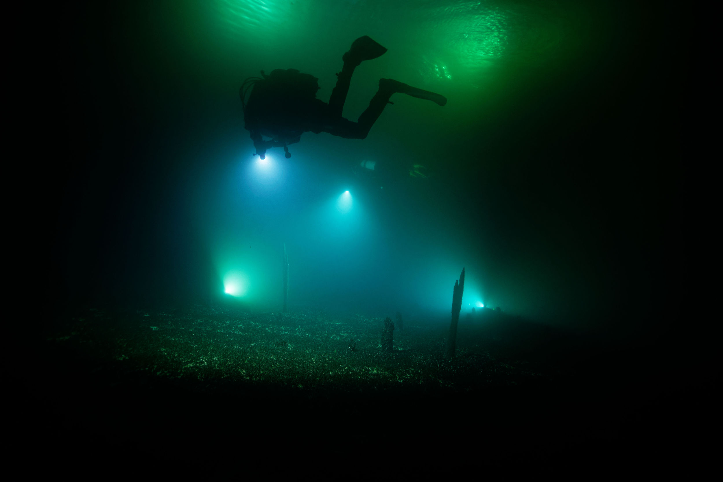 To do this, the Octopus Foundation team will bring together and make available to archaeologists its operational team as well as all of its navigation, diving, aerial and underwater imagery resources to carry out a first field mission in the spring of 2022. The elements recorded during this campaign should allow the laying of the foundations for the monitoring of Geneva lake sites which will be carried out in the years to come.
Location
For this field mission, the Octopus Foundation team will bring together a number of its marine tools to put them at the service of the Geneva archaeological service :
Aerial drones
The use of aerial drones is particularly useful for detecting underwater objects when they are in shallow and clear waters.
 By flying several tens of meters above the surface, the pilot may spot the zone of interest to later highlight it on a map and save time for future dives. The drone can thus scan certain areas which will then have to be excavated by the underwater archaeologists.
For this project, the use of several drones with different optics will help archaeologists collect valuable data on the ancient dwellings.
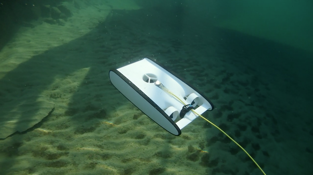
Underwater drone (ROV)
 Using the OpenRov Trident may help us to:
– preview an underwater area before sending a team of divers
– allow non-diver archaeologists to follow the underwater team and study techniques or submerged objects of interest
– capture images at depths and in areas difficult to access by divers
3D models of wrecks
Once the underwater photographic acquisition has been completed, the Octopus Foundation processes the data to obtain a 3D modeled area like the ones below.
By clicking on the symbol in the center of the window, once the model is loaded, you can rotate the area by clicking in the center and moving the cursor. You can also zoom and move the model by holding down the shift key.
These simple and free tools provided by the Octopus Foundation allow people with little or no diving experience to explore the depths of the lakes and seas, and study various archaeological pieces with no risk of damage.
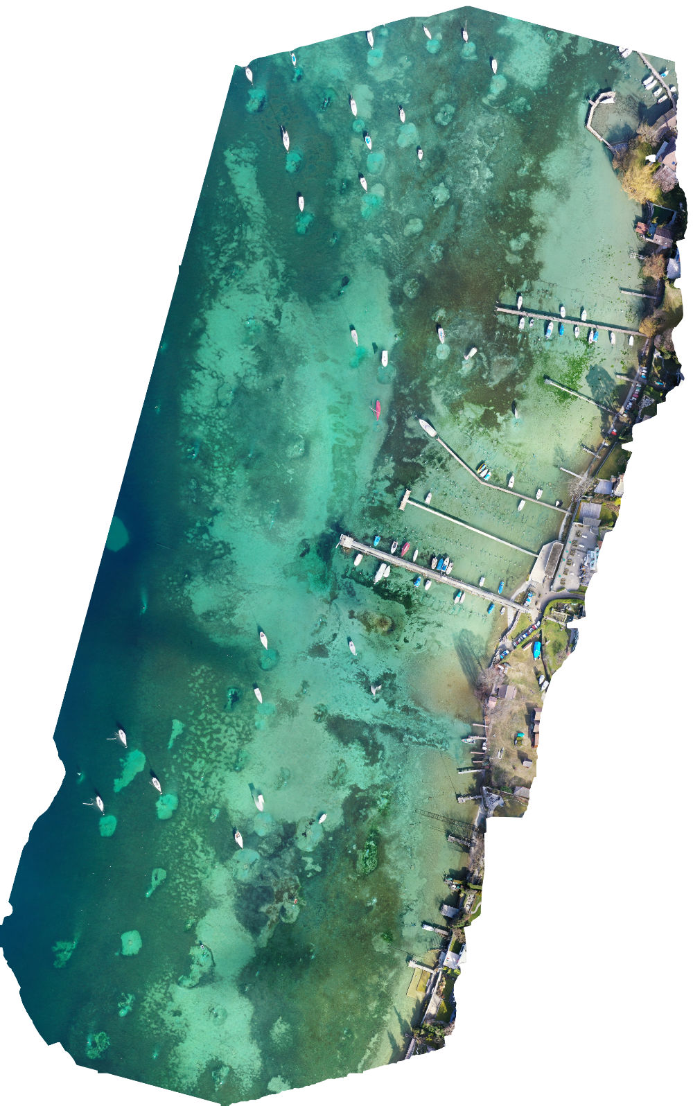
Photogrammetry
Photogrammetry is a very high definition plan, vertical projection of the 3D model. This plan is an essential tool for planning dives on a site or potential excavations in the bottom of the water.
Whether for the scientists, the public or diving enthusiasts, these digital models are effective visualization tools.
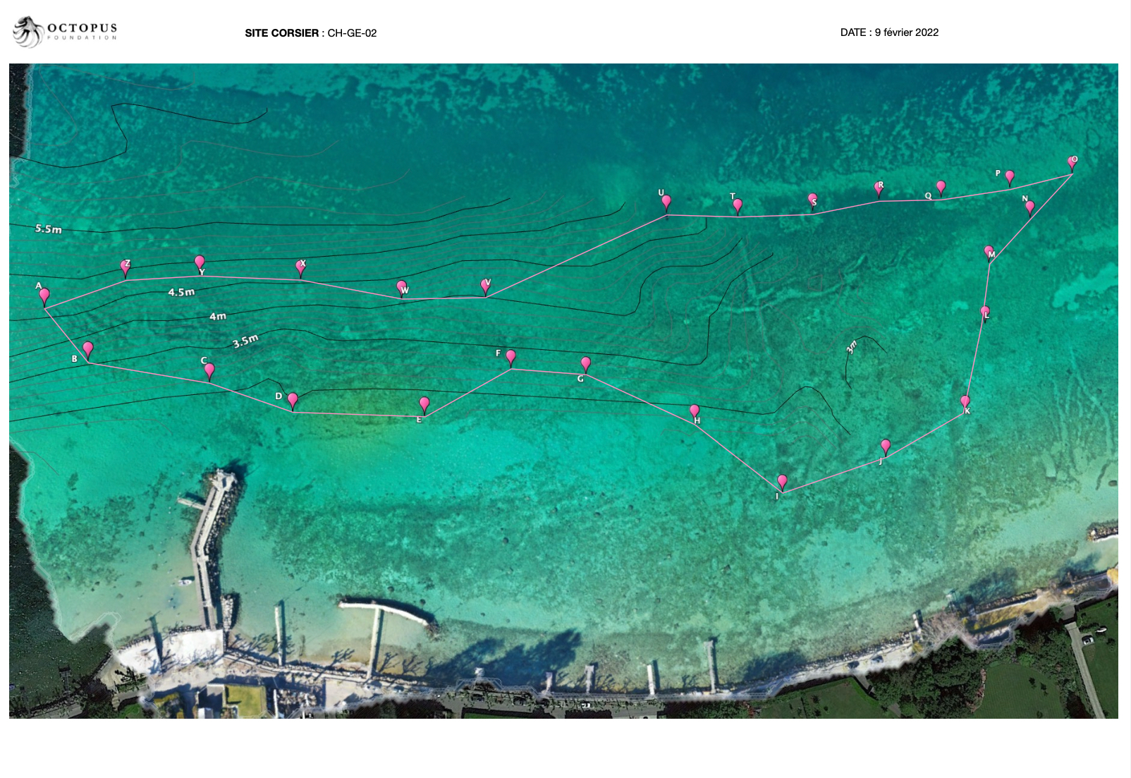
Here above is the aerial photogrammetry of the Corsier site (UNESCO classified site), one of the Geneva pile dwelling sites. On top of the photogrammetry image, we added the bathymetry layer created thanks to our mobile sonar.
From the digital 3D model, a simple visualization element, the computer software makes it possible to extract a tool which is scientific: the orthophotoplan. By a vertical projection of the entire relief on a horizontal plane, this centimeter-accurate map respects all the dimensions on the ground. While the diving time is limited by the air contained in a bottle, it is now possible to “take” the work area from the bottom of the water to study it carefully on land.
Location
At the end of 2021, the Cantonal Archaeology Department of Geneva, in partnership with the Octopus Foundation, decided to launch an introductory monitoring campaign of the pile dwelling sites located in the Geneva waters of Lake Geneva.
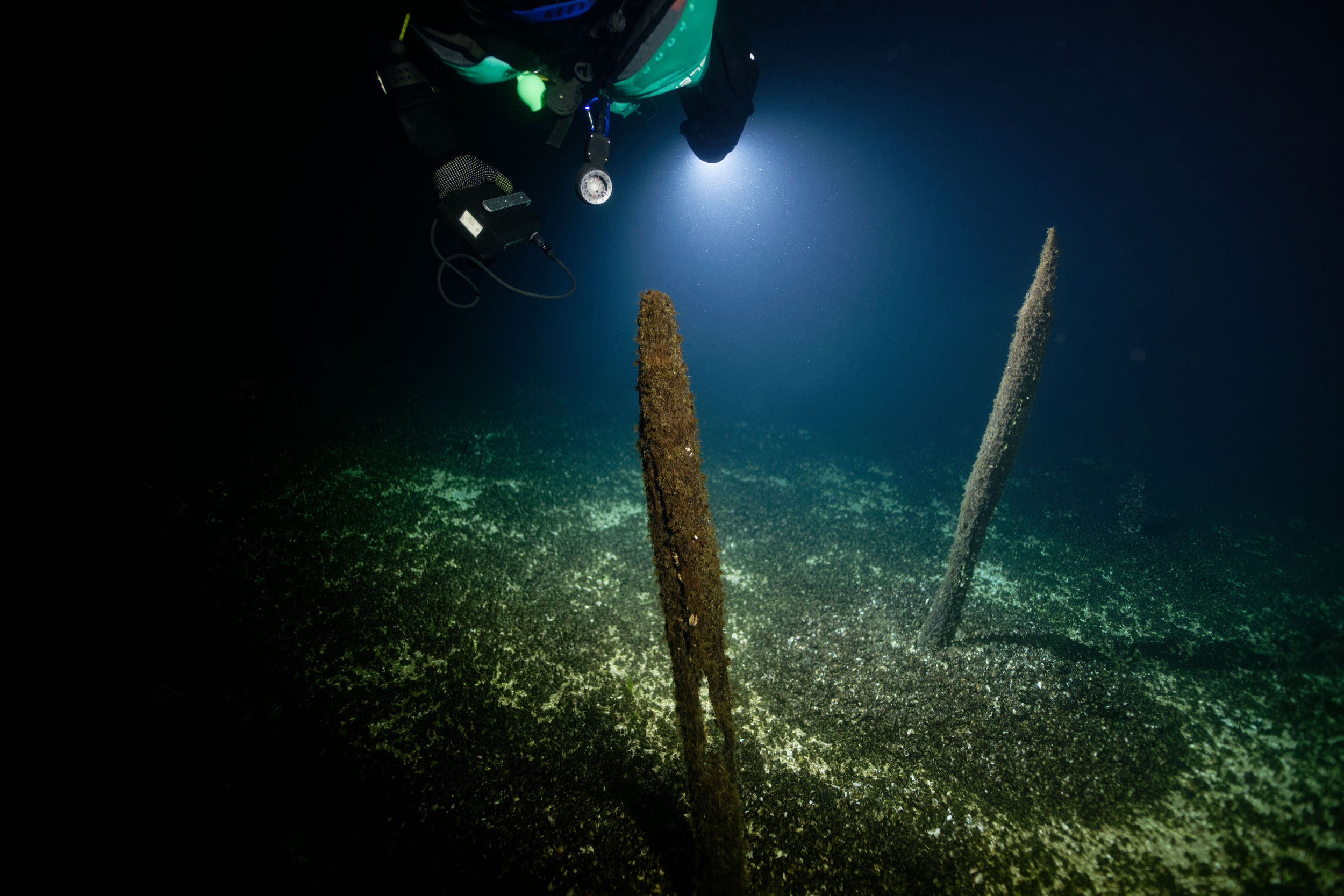
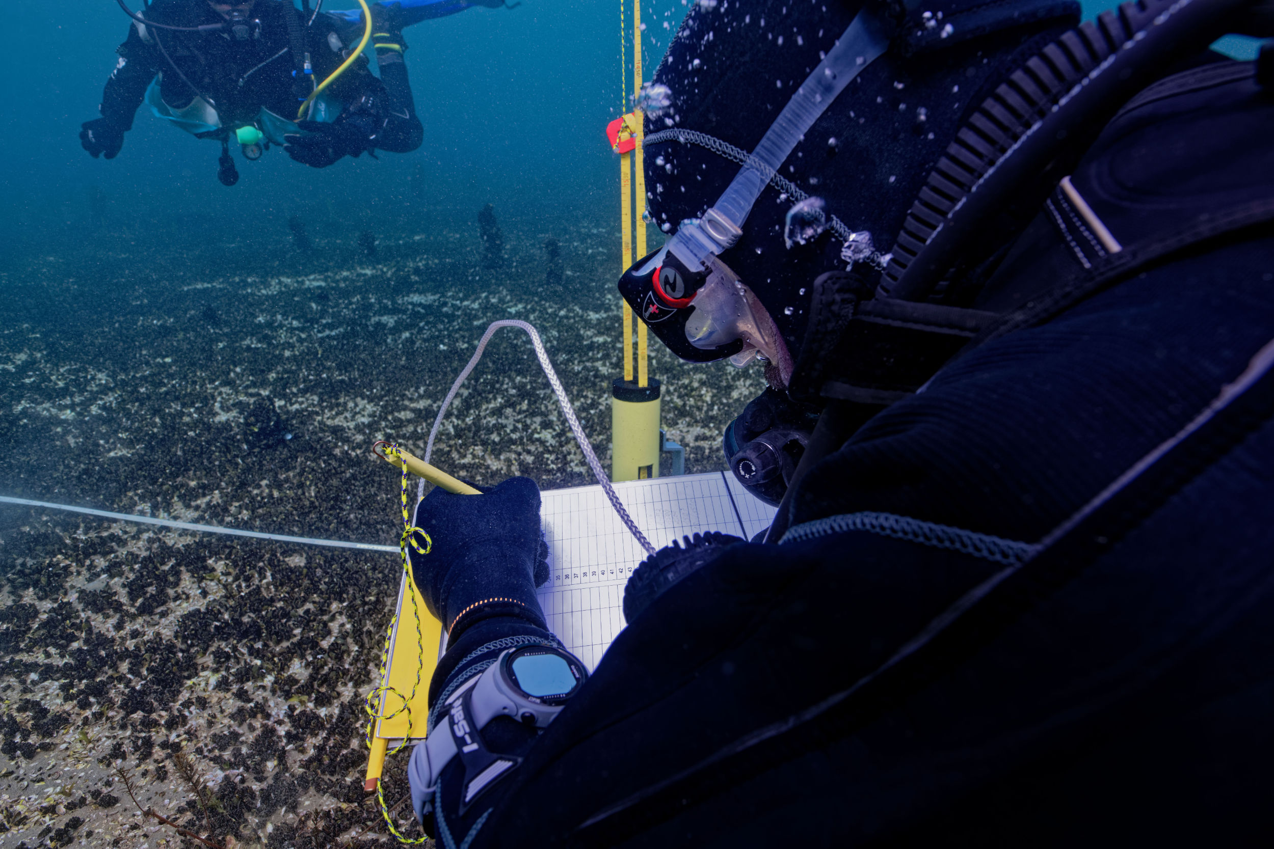
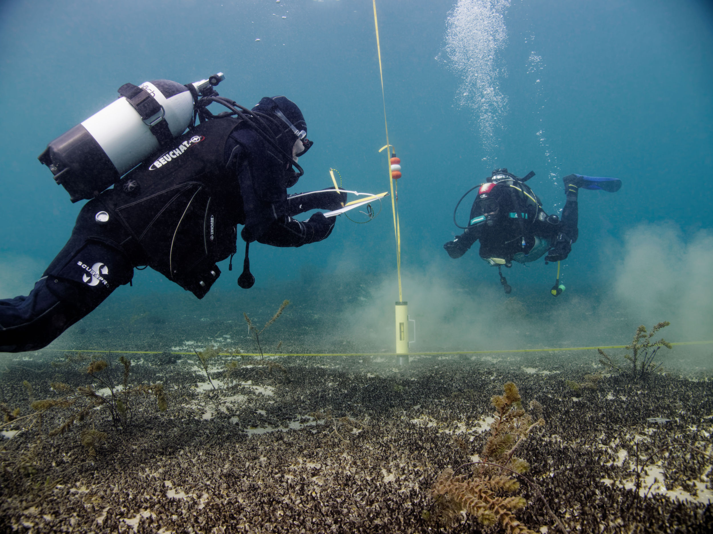
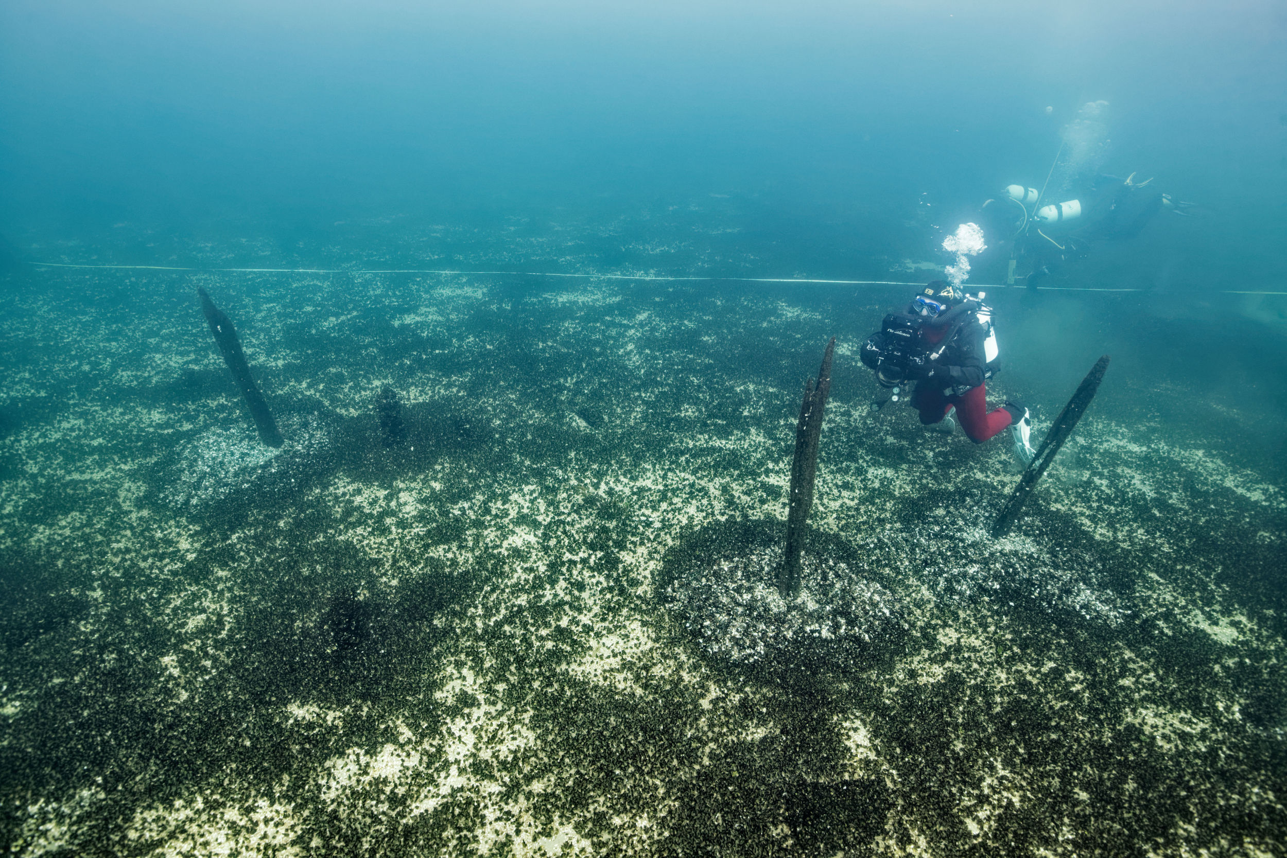
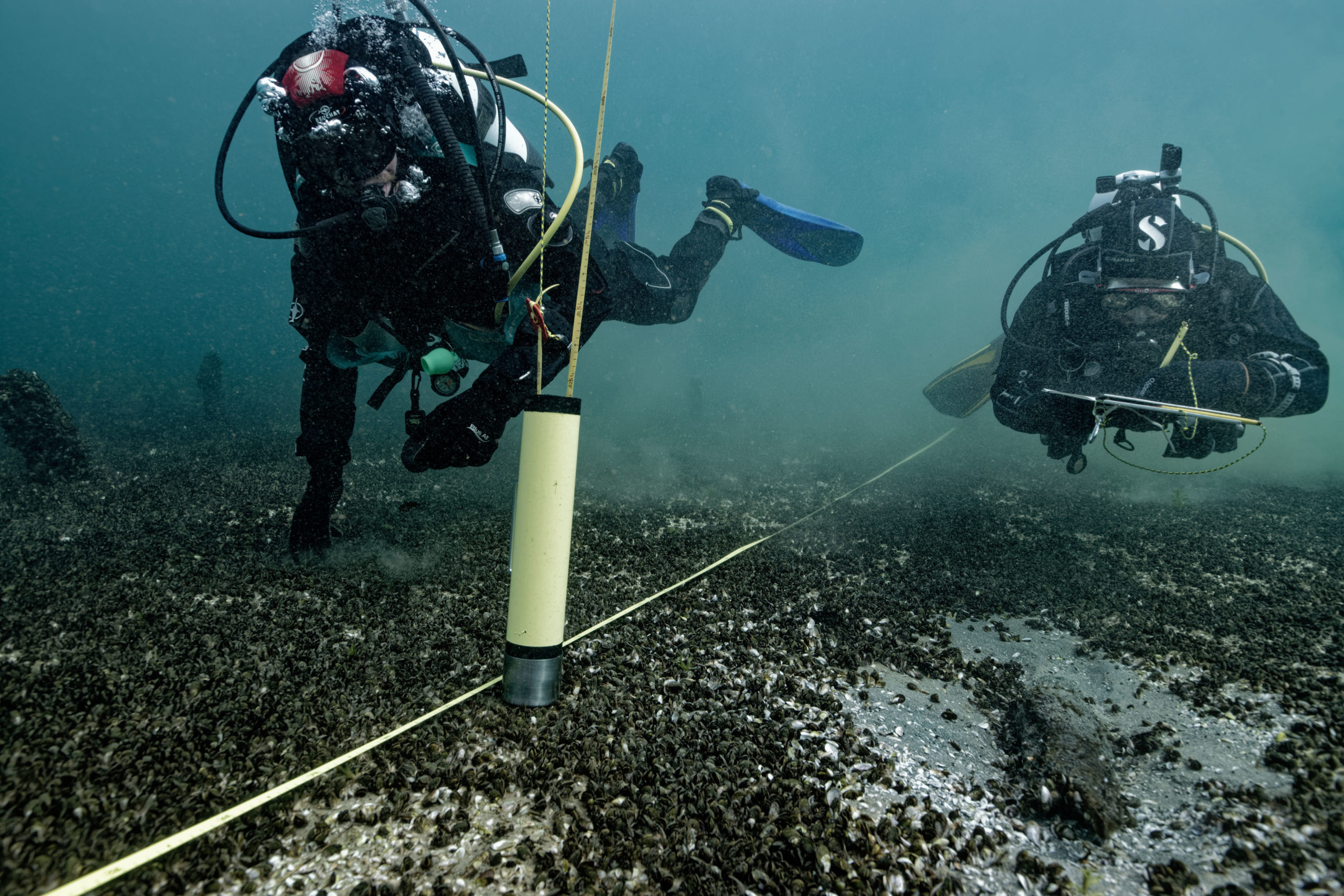
This campaign took place between March 14 and 23, 2022, bringing together a team of 10 people spread across two boats, enabling measurements to be taken, general documentation to be compiled, and monitoring markers to be put in place at the three UNESCO-listed pile dwelling sites (Versoix, Corsier, Collonge-Bellerive), as well as three additional sites (Anières, La Belotte, Pâquis) of importance to Geneva’s archaeology.
The scientific objectives, which were to document the current situation (2022) of the lake dwellings listed at the start of the mission, were achieved. Similarly, the other objective, which was to place and precisely position markers in the water for future regular monitoring, was also successfully completed.
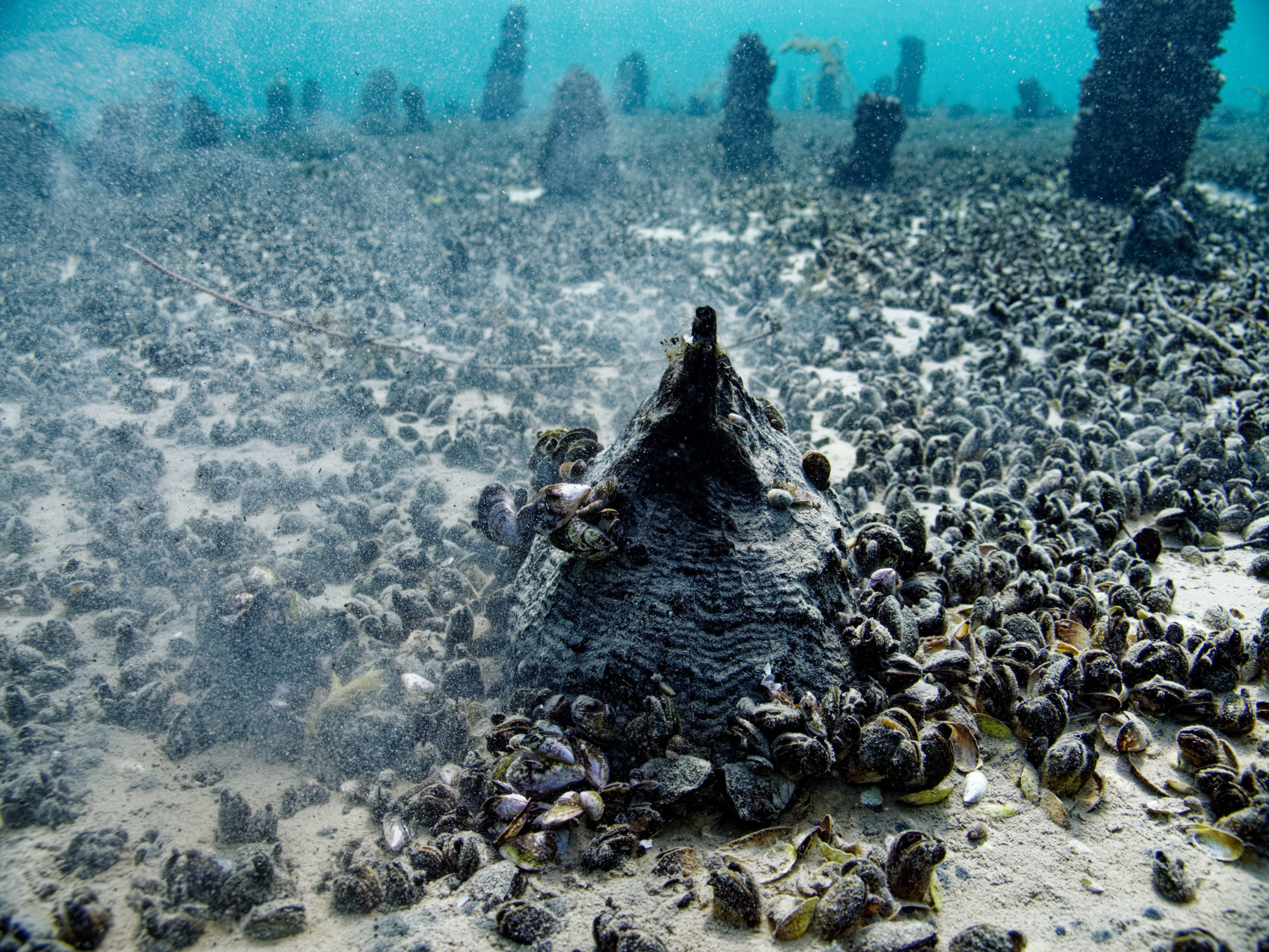
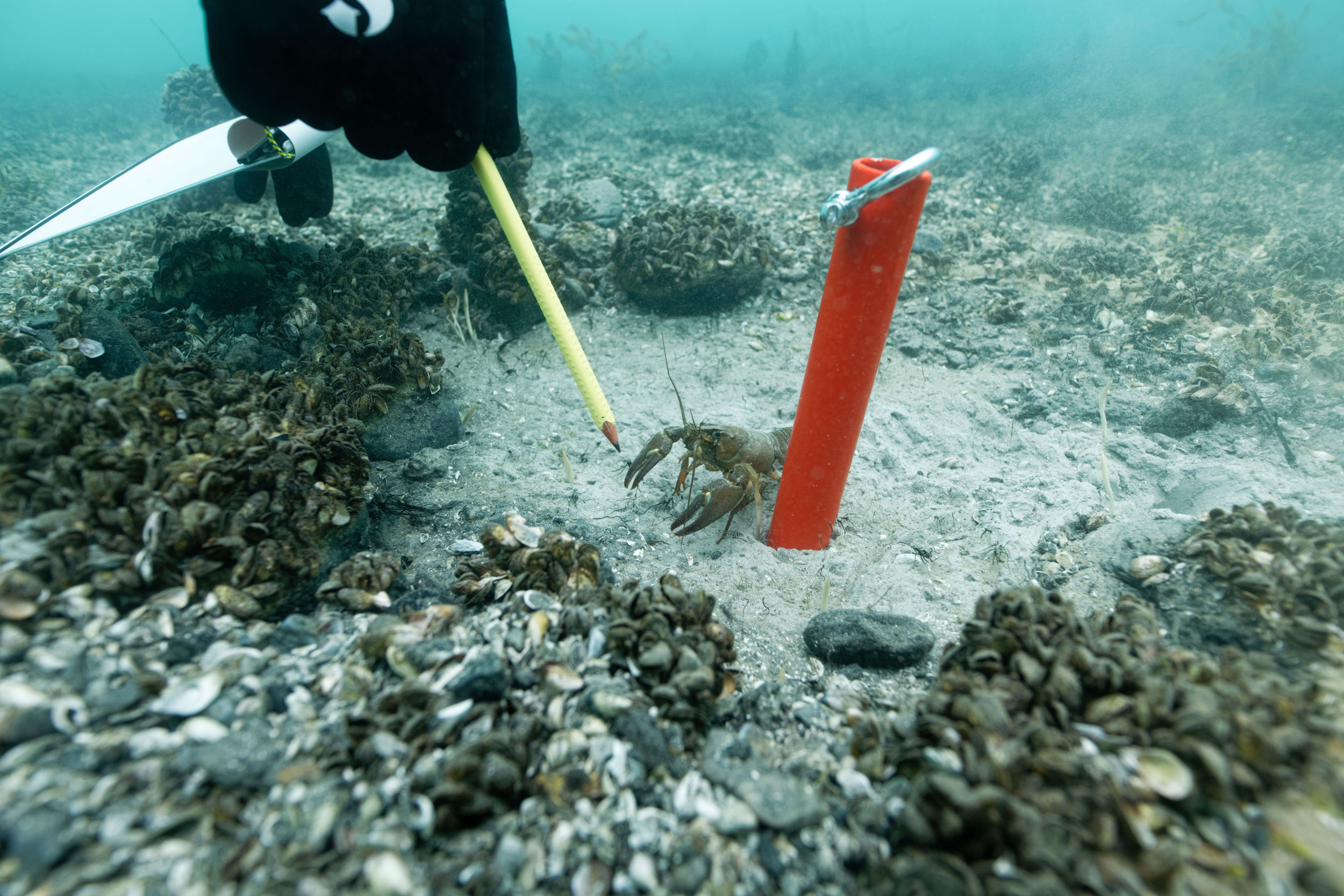
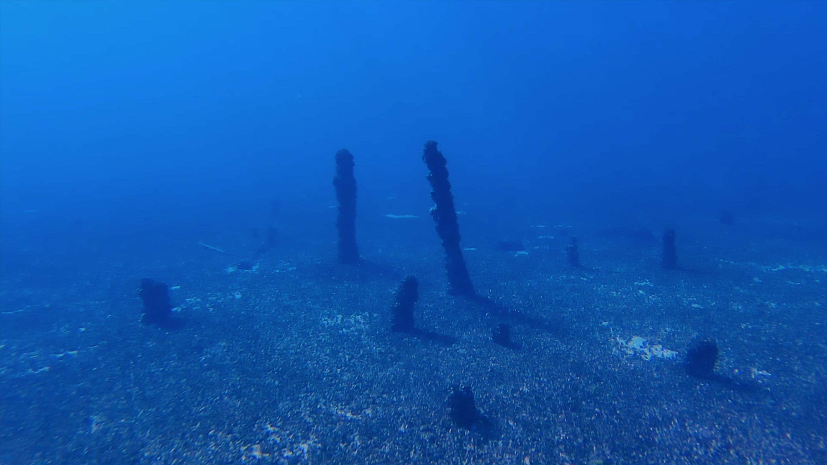
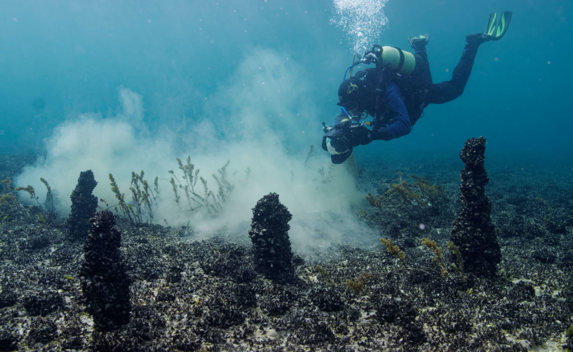
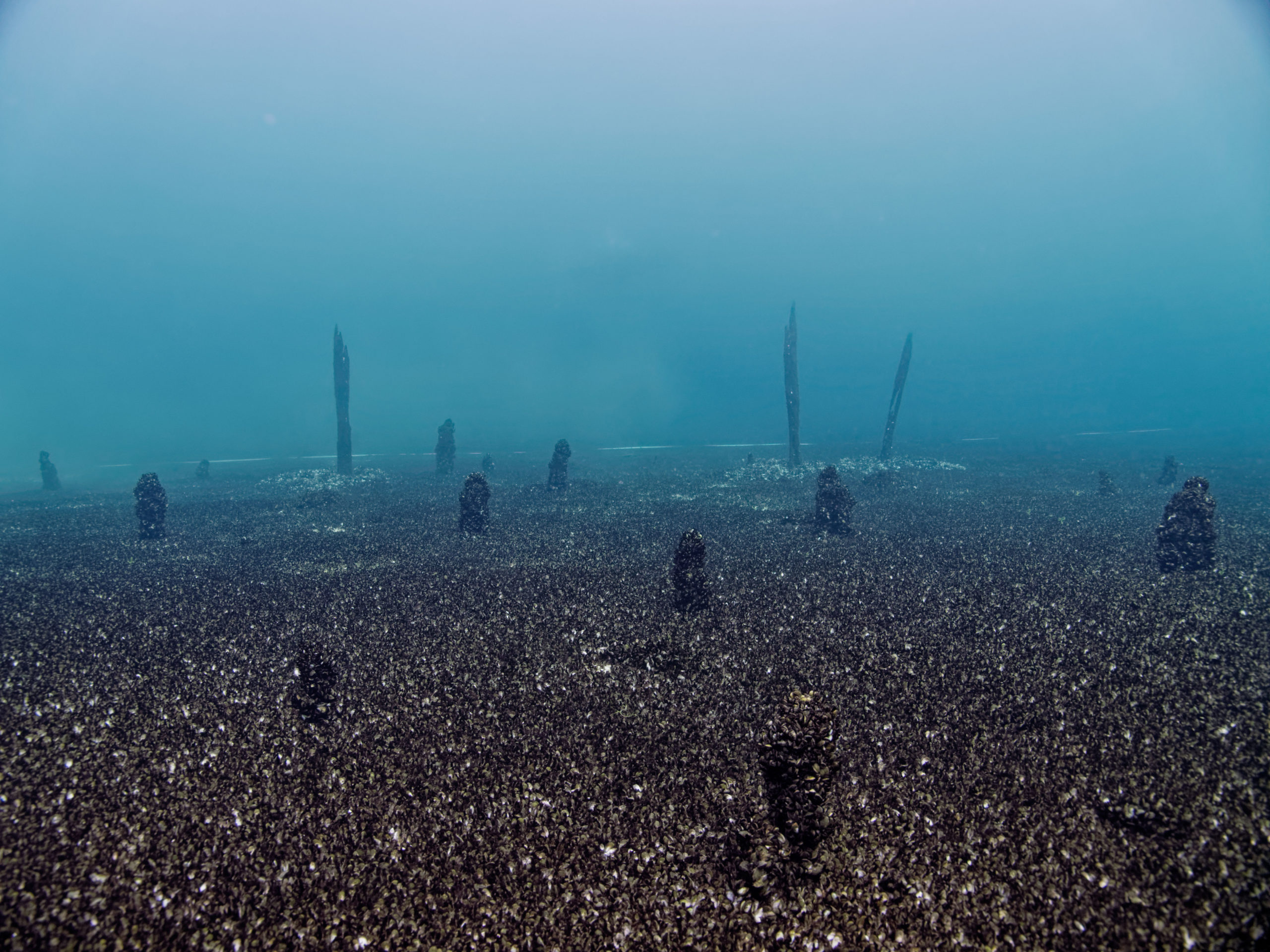
It is worth noting the very strong presence of invasive Quagga mussels (native to the Black Sea) at all the Geneva sites. Their presence is not limited to hard objects such as stone or wood, but the mollusks spread out in thick mats several centimeters thick on soft substrates such as sand or lake chalk. It would appear that the waters of Geneva are particularly affected by this invasive mollusk.
The second observation concerns mooring buoys, consisting of a concrete block (whose weight is generally proportional to the weight of the moored boat), a chain, and a buoy on the surface. It was clearly documented during this mission that the chain of these moorings caused damage to the lake bed by digging into it with circular movements around the concrete block. This degradation could prove to be even more problematic in archaeological areas such as the Belotte site.
The Octopus Foundation would like to warmly thank cantonal archaeologist Nathan Badoud and the Department of Archaeology of the Canton of Geneva for placing their trust in us.
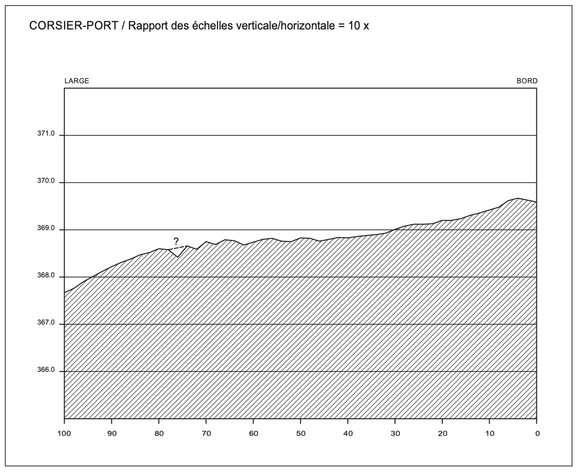
Corsier site profile, made by Pierre Corboud © Service d’archéologie du canton de Genève
Location
Team members

Julien PFYFFER
Founder and chairman

Sebastien ROUSSEAU
Navigation manager

Philippe HENRY
Director of Photography
Christophe VIGNAUX
Diver and skipper
Andy GUINAND
Head of robotics
Partners
Cantonal Archeology Service (Geneva)
Heritage and Sites Office
Gallery