
The ancient port of Oricum (Albania – 2017)
Of the many archaeological treasures in Albania, the ancient port of Oricum is arguably one of the most intriguing. This forgotten city played a crucial role in Julius Caesar’s ascent to total domination. Yet, during the better part of the 20th century, the communist regime isolated Albania from the rest of the world. Archaeologists are only now scratching the surface of the site’s potential.
History
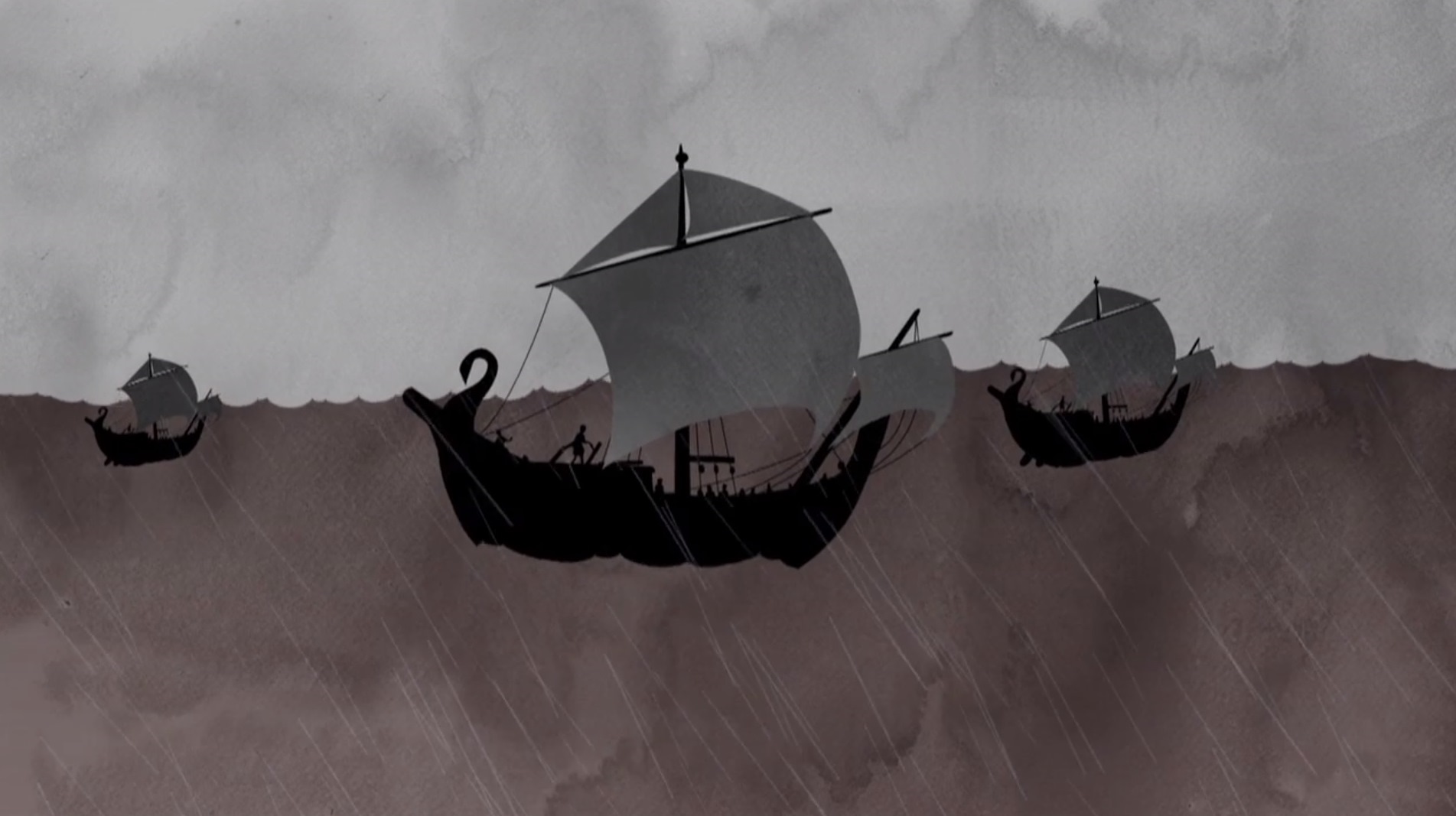
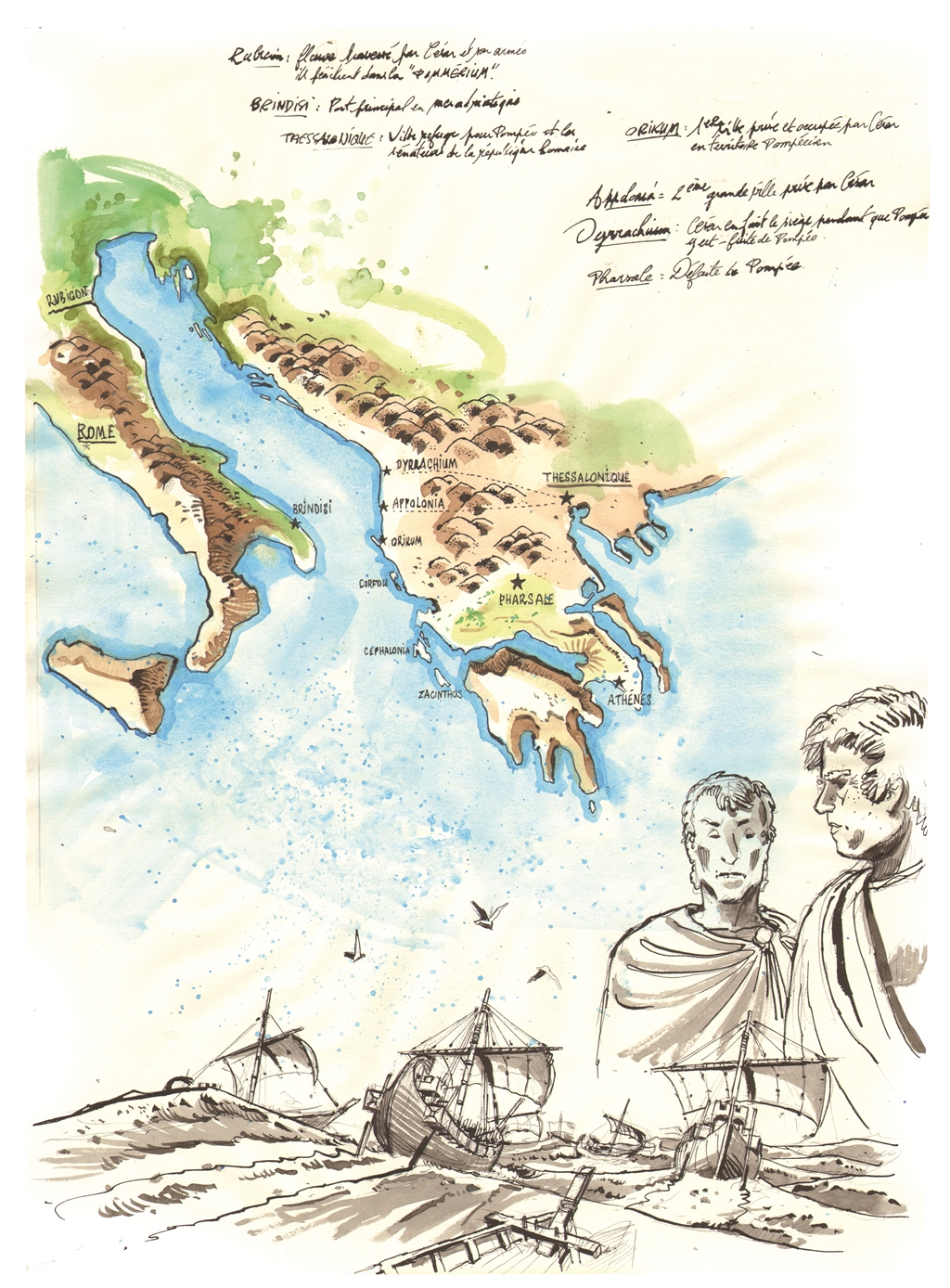
“Alea jacta est”, famously declared Julius Caesar as he crossed the Rubicon river with his army in 49 B.C., unceremoniously declaring war on his biggest enemy, Pompey. “The die is Cast”.
Pompey hastily fled with his faithful senators to the other side of the Adriatic Sea, comfortably out of reach of his aggressive opponent. Or so he thought. Caesar didn’t become the general of a powerful army by accident. Coming up once again with a masterpiece of a strategy, he decided to sail across the Strait of Otranto during a stormy night of October, on commercial ships.
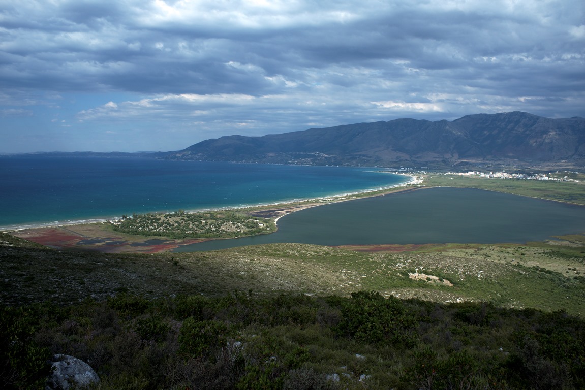
This senseless act of bravery paid off. The elite troops managed to beach, undetected, in the quiet cove of Palasë, not far from Oricum, one of the most strategic positions in the region controlled by Pompey. The sleepy guards assumed the menace would come by way of sea. Little did they know that a terrestrial attack was about to storm on them.
 “Oricum was a highly strategic port back then, explains Julien Pfyffer, founder and president of the Octopus Foundation. It is situated at the crossroad of the Adriatic and Ionian Sea. It hosted this crucial episode of Julius Caesar’s military career, at the very beginning of the Great Roman Civil War. A bloody battle opposing two very clever strategists fighting for the ultimate power. It was incredibly risky to reach and conquer this position. Caesar’s story could have very well ended abruptly at sea, in the storm. Looking into ancient Oricum, it’s looking through pages of History books that remain surprisingly empty.”
It’s only very recently that archaeologists have attempted to fill these gaps. Oricum is today part of modern Albania. A country completely cut off from the rest of the world for the better part of the 20th century. In the early 2000s, a team of Albanian and Swiss archaeologists were finally granted access to this exceptionally undocumented site.
“Oricum in Latin, or Orikos in Greek, was already known as a port city well before the Romans occupied it, says Gionata Consagra, doctoral researcher at the University of Geneva and coordinator of the archaeological project. The first mentions were written in Greek, already labeling it as a port. Later, the Romans used the city as a port of disembarkation for their military troops. It became a bridgehead between Italy and this whole part of the Balkan region.”
 The small but strategic city was occasionally mentioned in the ancient texts, with little to no descriptions. The authors not bothering with details. Everything changed with Caesar’s arrival in 49 B.C. In his memoirs of the Civil War, the famous general described the harbor and its surroundings. “Oricum is the first port captured by Caesar on his pursuit of Pompey, explains the Swiss archaeologist Gionata Consagra. After several short mentions, a battle took place in the city. While describing it, Caesar gave us very precise topographical details. Incredibly, they match the actual landscape. It leads us to believe there were very few topographical changes in the past 2000 years, as the sea still ends roughly at the same place.”
In the book 3 of the Civil War, it is in these terms that Caesar described one of the battles that took place in Oricum: “Cneius, Pompey’s son, who commanded the Egyptian fleet, having got intelligence of these things, came to Oricum. […] He overpowered our men by fatigue, and the immense number of darts, and took the ship, having beat off the men that were put on board to defend it, who, however, made their escape in small boats; and at the same time he seized a natural mole on the opposite side, which almost formed an island over against the town. He carried over land, into the inner part of the harbor. […] Then attacking on both sides the ships of war which were moored to the shore, and were not manned, he carried off four of them, and set the rest on fire.” Despite this lost battle, Caesar ended up winning the war against Pompey to become the new Imperator (the meaning is closer to dictator than emperor nowadays). This entire war has been thoroughly studied and documented by armies of historians, who dissected every bits and pieces. All, but the puzzle-piece named Oricum.
Today
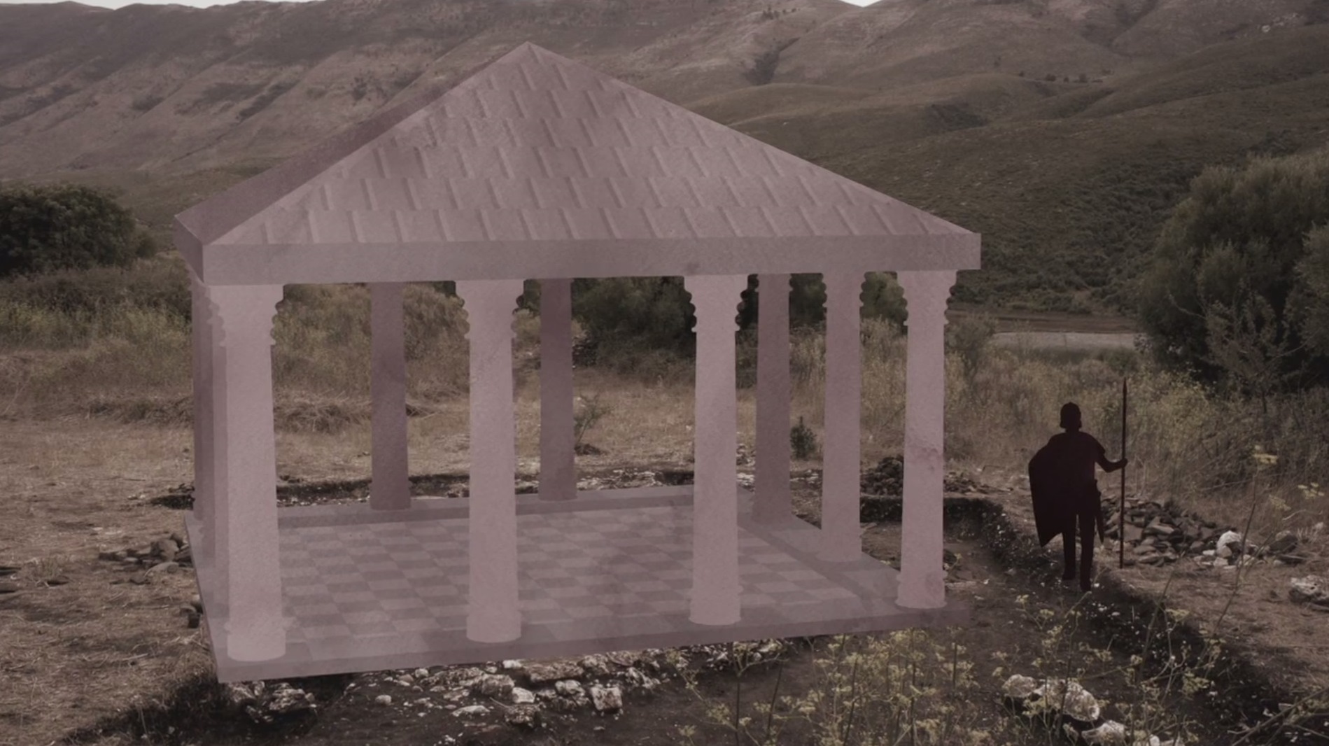
The first modern archaeological survey of the site took place in 2008. In the following eight years, les teams of scientists performed several excavation sessions, always focusing on the terrestrial remains. After years of study, the monument known as the “Theater” revealed its true function: it’s in fact a monumental fountain (see episode 4 of “Orikum’s Mysteries). A door in the fortification wall was also discovered, further confirming that Oricum was a port sufficiently strategic to be surrounded by strong defenses.
 Finally, further up the hill, the remains of a square building of great standard was revealed. Its hand-made terracotta floors confirm the craftsmen’s precision and quality of work. Amongst the remaining objects, many baked clay weighs were found. In the Antiquity, they were used to hold the thread on a loom. The people of Oricum probably used this building to manufacture garments and sails. At that time, many boats were necessary to ship the fine white rocks that were mines in the neighboring quarries of the Karaburun.
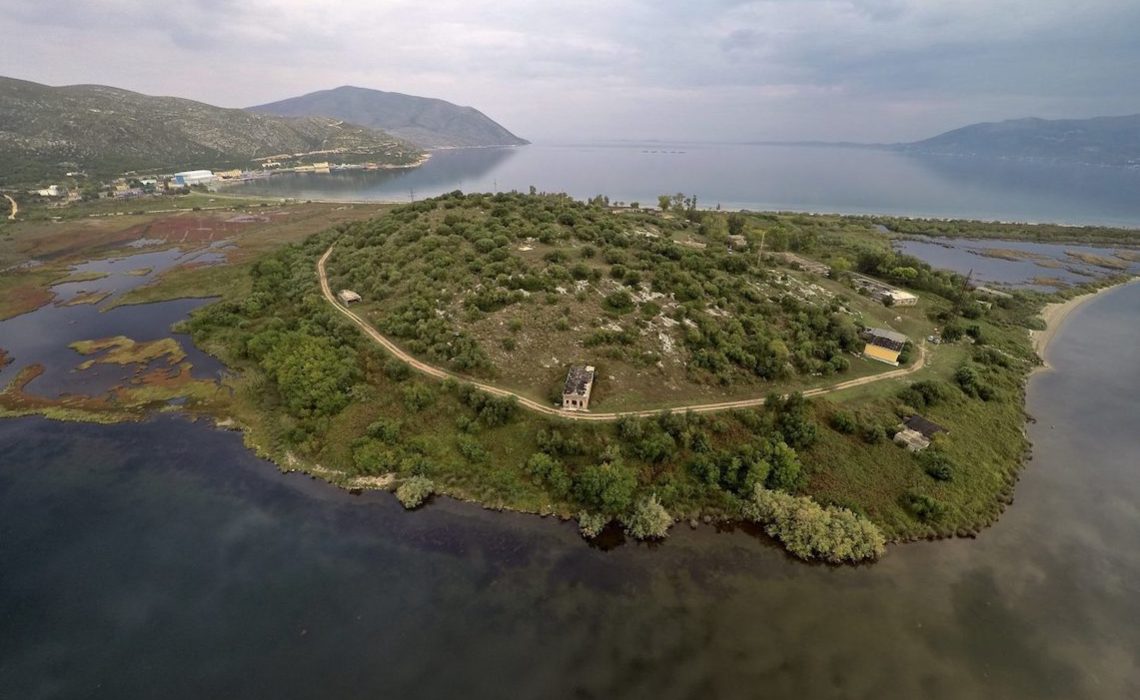
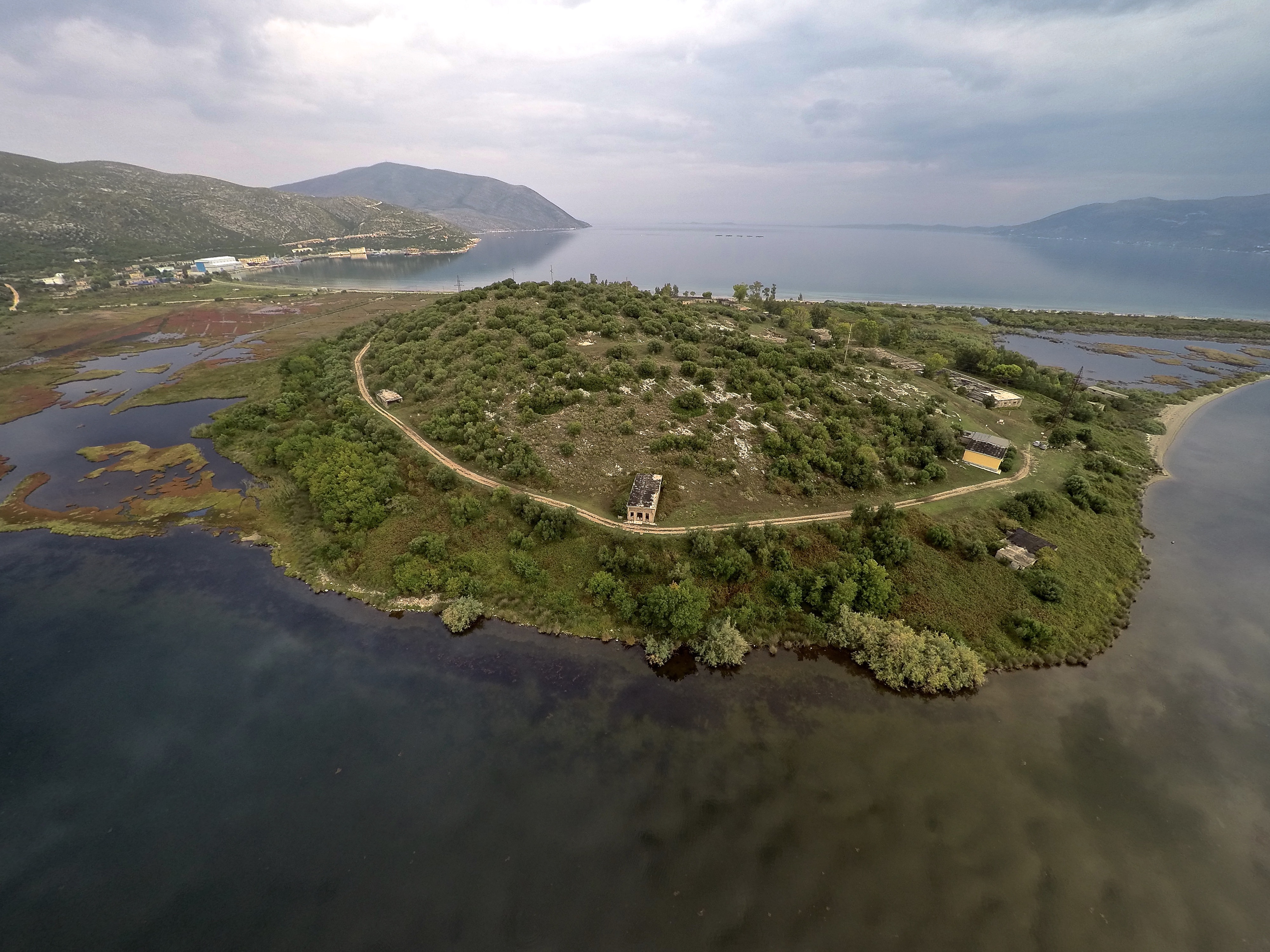
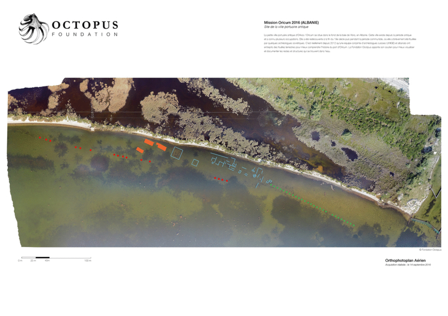
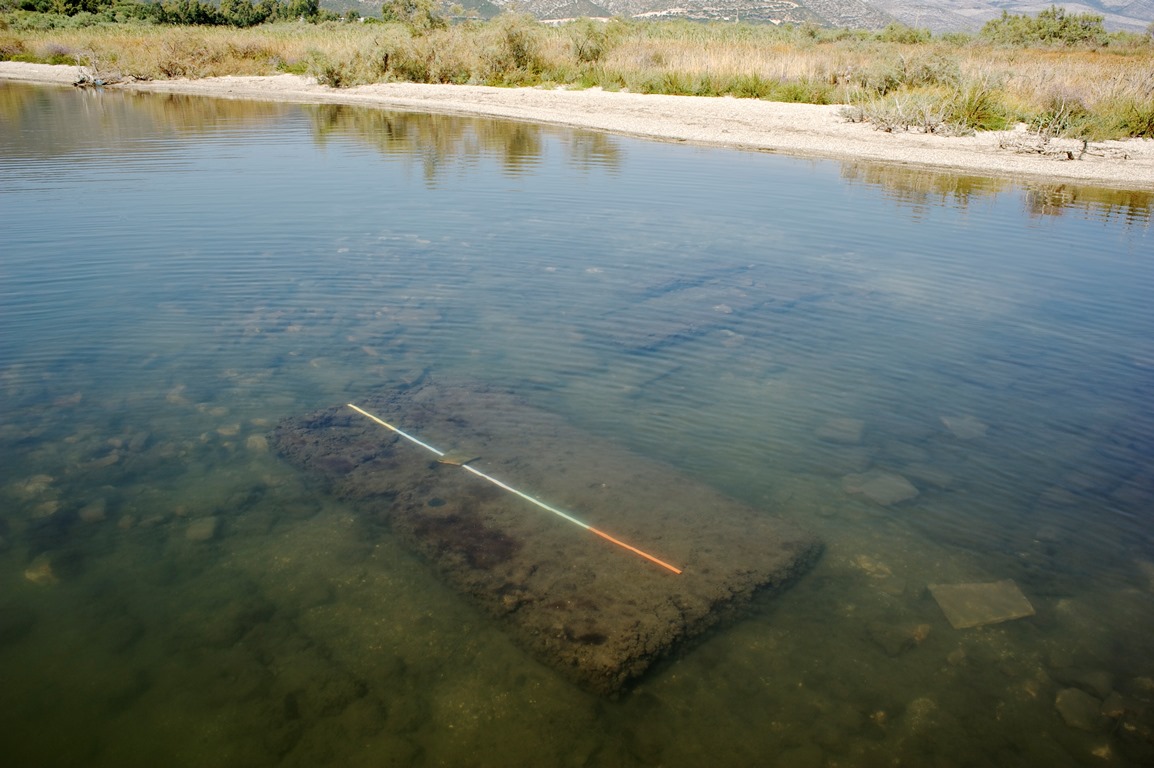
In 2016, while studying said quarries, the Octopus Foundation also took a look at the lagoon, where hundreds of unsuspected structures were found. All of these remains share an interesting aspect: they lie under the surface of the water, several dozens of meters away from the ancient city. The time has come to study what could very well be the remaining traces of the ancient port of Oricum.
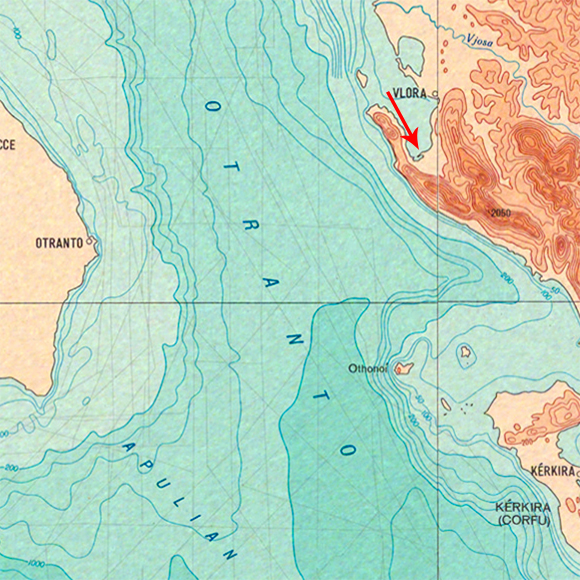
Location

Logistic support to the team of archaeologists
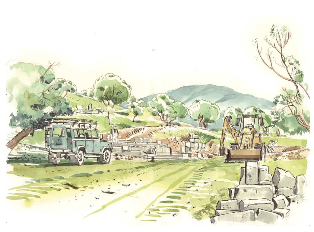
The archaeological excavations of the ancient city of Oricum truly began less than ten years ago. At first, the scientists focused on the remains found on land. Prior to their first expedition, several structures were unearthed, yet their function remained mysterious.
 Since 2008, the teams of scientists managed to expand our knowledge of the city. For example, they demonstrated that the structure largely known as the “Theater” was in fact a public place with a complex water management system that ends in a monumental fountain. A door in the fortification wall confirms the hypothesis that Oricum was a strategic port well-guarded and defended. Finally, many terracotta objects found in a square building of great standard could prove that the town had its own manufacturer of sails.
Most of the clues found on land point towards an intense port activity, which would have been developed in order to transport the tons of white rocks quarried in the immediate vicinity of the ancient city of Oricum, on the shores of the Karaburun.
Today, what remains of this important port described by Julius Caesar himself?
Helped by one of its aerial drones, the Octopus Foundation produced an orthophotoplan (aerial photographic map) of the lagoon. This tool of exceptional precision revealed hundreds of submerged structures a few meters away from the beach. “The idea is to use this aerial photographic map made in September 2016 as a starting point for the 2017 mission, explains Julien Pfyffer, president of the Octopus Foundation. Our objective is to study these submerged remains in order to date and authenticate them. Ideally, the archaeologists would like to know if they are ruins of the port described by Caesar in his writings.”
The specialized crew, especially brought together by the Octopus Foundation for this mission, will assist a freshly recruited scientist. Krisztian Gal is a 40-year-old archaeologist and scuba diving instructor from Hungary. He currently lives in Geneva, and is specialized in submerged ruins. “Some archaeologist take a bike to work, he says, and others a boat. The task is the same. Diving is simply a tool to get the job done.”
 “Krisztian worked in Swiss lakes for several years looking for the remains of Neolithic villages, says Julien Pfyffer. He will supervise the scientific operations in Oricum’s lagoon. The Foundation’s team will be his eyes and hands. We will also give the archaeologists access to our technological tools, in order to take underwater photographs, to create 3D models, to send our drones in the air or in the water. The aim this year is to observe and understand what hides beneath the surface.”
Gionata Consagra, coordinator of the Albano-Swiss archaeological mission to Orikos-Oricum, warmly welcomes the help provided by the Octopus Foundation: “Because of the Foundation’s interest and means, we were able to discover hundreds of undocumented structures. This year, Julien Pfyffer and his team will bring a precious help to Krisztian Gal. He will be able to rely on experienced divers to conduct precise surveys of the underwater structures. Without the Octopus Foundation, we would have been forced to put together a team of students interested in underwater archaeology. A branch that simply doesn’t exist in Switzerland at the moment.”
Location
3D model
The archeologists of the University of Geneva and the Albanian Institute asked the Octopus Foundation to search in the sea and the lagoon surrounding the forgotten city for ancient structures. After the 2016 mission, the Octopus Foundation is proud to present several models made from hundreds of photos.
Below is a multi-layer 3D model highlighting a part of the coast that was excavated by the craftsmen of the time. The white rocks of the Karaburun were used by stone cutters throughout the Roman empire, all the way to the capital, Rome. With this model, we can clearly see the zones that were quarried by the craftsmen more than 2000 years ago.
How to use the model: After clicking on the “play” symbol, and once the buffering is completed, it’s possible to click in the window and drag the pointer in any direction. It is also possible to zoom in or out, by pressing and maintaining the “shift” button.
With a free and simple tool, the Octopus Foundation is able to bring the public to an important ancient site, and present archaeological treasures, on land or at sea. Such as the forgotten city that was built on a rocky hill:
Orthophotoplan
Whether it is for the public or for scuba diving enthusiasts, these models are efficient visualizing tools of the underwater world. But are they really useful to scientists? One of the main objectives of the Octopus Foundation is to help scientific research and the exploration of the subaquatic world.
From the 3D modeling which is a simple visualization element, the computer program can also create a scientific tool: the orthophotoplan. From a vertical projection of the whole of the relief on a horizontal plan, this precise map respects all the real scales.

Comic strip
 Because the Octopus Foundation’s wish is to bring awareness to a public of all ages, we will be describing our projects through comic strips. The Foundation’s crew is not only composed of divers, sailors, journalists, biologists and historians, but we are also lucky to have Antoine Bugeon, a young and talented designer who happens to be an experienced sailor.
We asked him to draw what happened behind the scenes of the Oricum-2017 expedition, so that the reader can understand the importance of this historical site.
Here, Antoine managed to capture the atmosphere of an excavation session.
Location
Follow the crew of the Octopus Foundation on the footsteps of Julius Caesar in Albania, through the following Web series with English subtitles:
Location
Team members

Julien PFYFFER
Founder and chairman
Ariel Fuchs
International advisor

Philippe HENRY
Director of Photography
Antoine BUGEON
Cartoonist and sailor

Sebastien ROUSSEAU
Navigation manager

Margaux CHALAS
Sailor and stewardship
Christophe VIGNAUX
Diver and skipper

Andy GUINAND
Head of robotics
Krisztian Gal
Underwater Archaeologist
Partners

OpenRov
Technology partner

UNIGE
The University of Geneva