
The port of ancient Eretria (Greece, 2024 – 2026)
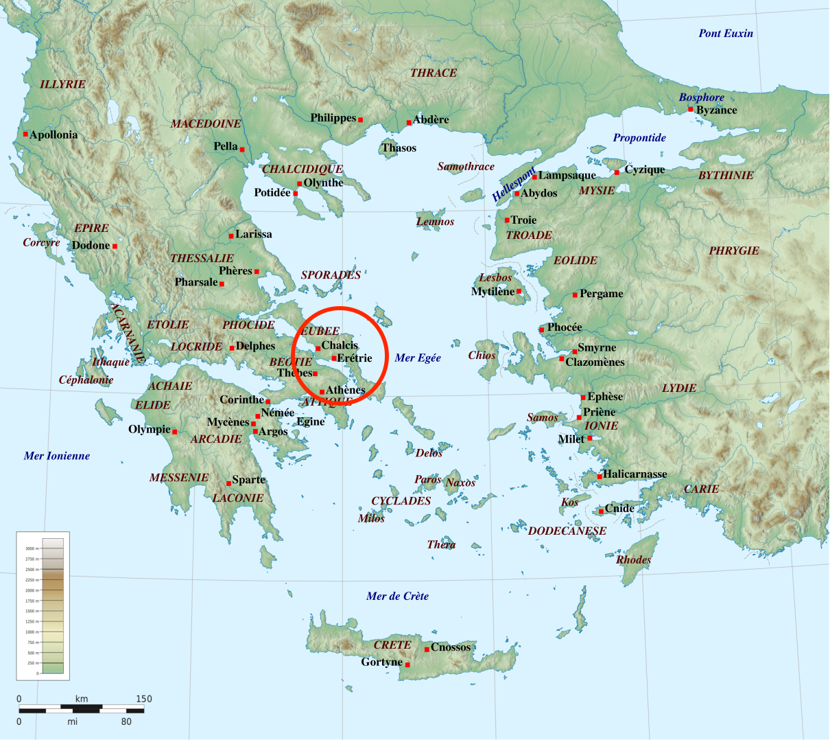
Located on the island of Euboea, Eretria is one of the first major cities of Classical Greece, having emerged around 700 BC. This important site has been excavated on land since 1964 by generations of Swiss and Greek archaeologists. However, the city’s underwater remains has never been explored, starting with its port, now largely submerged. Yet, it is of great importance, as Eretria means “city of the rowers.”
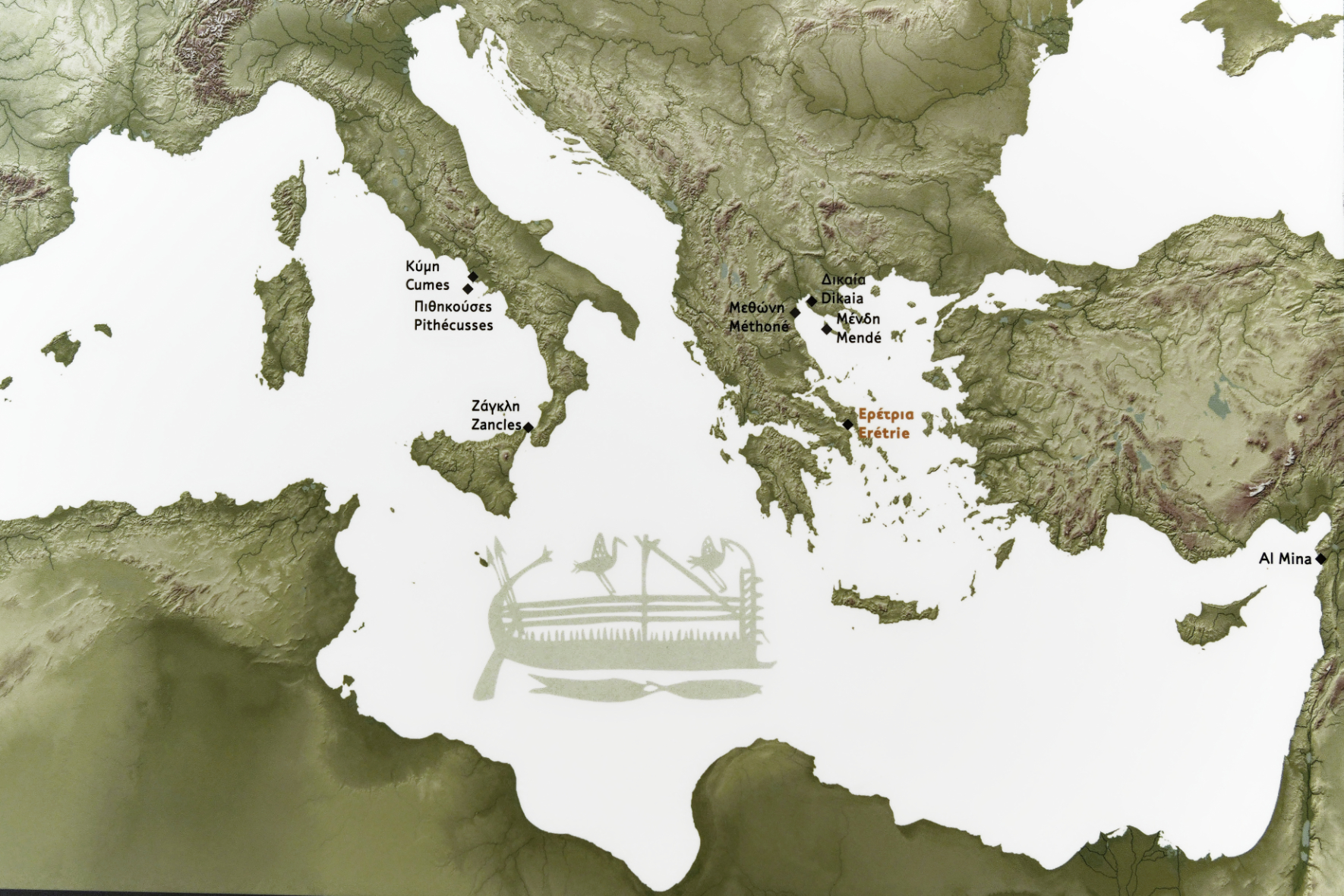
An important city of ancient Greece, Eretria exists from the Bronze Age (3000-1100 BC). Its inhabitants were among the first to explore the Mediterranean basin as early as the 8th century BC, where they founded colonies and trading posts. A link between East and West, Eretria’s contribution proved essential in the spread of the Semitic alphabet and Eastern myths to the West.
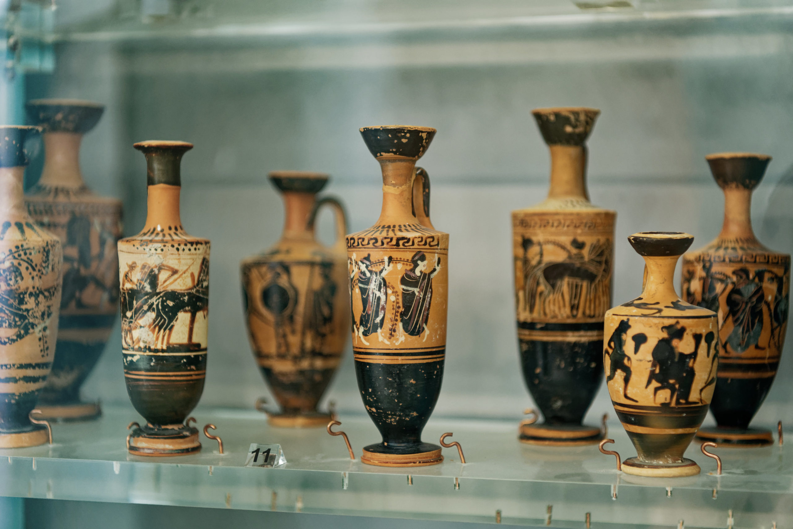
A colonial and commercial power, Eretria took part in the many conflicts that shook Greece: sacked by the Persians in 490 BC, the city experienced a flourishing period in the 4th and 3rd centuries BC, during which luxurious houses were built.
Throughout ancient history, the Eretrians have repeatedly demonstrated that they are experienced sailors, as colonies of the city appeared as early as the 8th century on the border between Turkey and Syria (colony of Al Mina), in Sicily (Zancles) and as far as the Bay of Naples (Pithecusses on the island of Ischia).
 Captured by the Romans in 198 BC, Eretria’s influence slowly declined until the end of the 6th century AD, when the town appears to have been abandoned.
Visited by a few travelers and antique dealers during the medieval and modern periods, the city was restored in the 19th century by the new Greek state to accommodate Greek refugees expelled by the Ottomans from the island of Psara.
The exploration of the ancient remains of Eretria, which began more than a century ago (1964 for the Swiss), is still ongoing, mainly thanks to Greek and Swiss archaeologists.
Location
Since the first archaeological excavations conducted in the 19th century, no systematic research had been devoted to the port of the ancient city.
The lack of data on the port of the ancient city, resolutely focused on navigation and trade from its origins, is a serious deficiency. Faced with the dangers linked to the development of the modern city, and particularly to a proposed new marina, a comprehensive study was essential.
For the first time in the history of the excavations at Eretria, since Greek and Swiss archaeologists began excavating the city in 1964, ESAG has obtained a three-year permit from the Greek Ministry of Culture to assess the underwater remains located between the inner harbor area and around the breakwater that runs north to south along the western side of the harbor. This permit authorizes a team of archaeologists and technical divers to evaluate the underwater archaeological potential of the ancient city for three years (2024-2026).
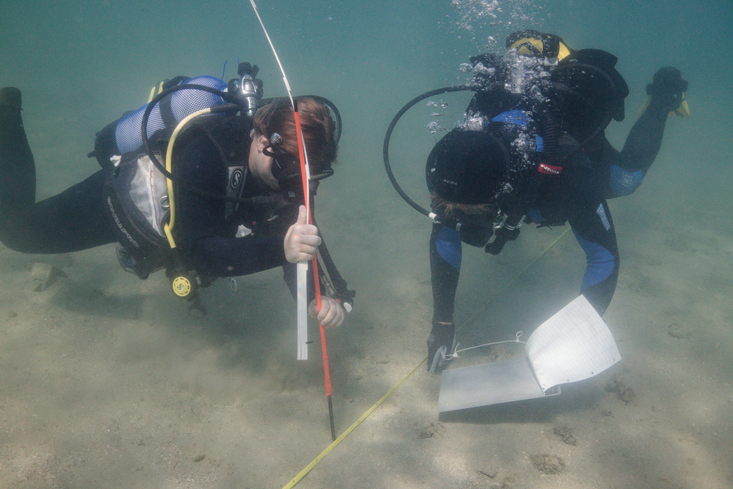
During the first campaign in 2024, the objective was to visualize, document and position the visible structures located on the beachfront as well as in the sea.
To do this, the Octopus Foundation team, under the direction of Sylvian Fachard (director of ESAG), Fabien Langenegger (archaeologist) and Despoina Koutsoumba (Greek underwater ephoria), set up all the diving logistics, plan the teams and rotations of divers on the selected sites and produce a series of technical documents (bathymetries, photogrammetries, etc.) which will allow the planning of future training excavations in the coming years.
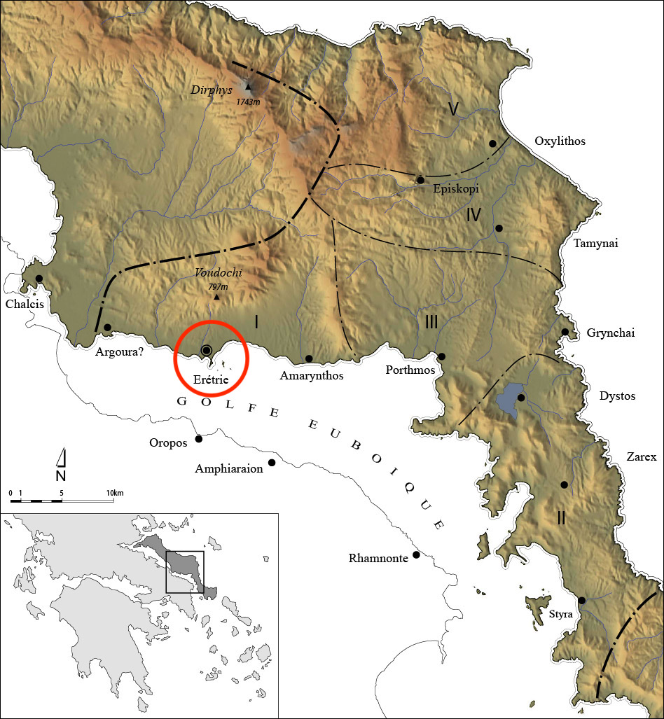
Location
2026 campaign
Since 2024, the port infrastructure of ancient Eretria has been the subject of a systematic research program, the result of a collaboration between ESAG, the Ephorate of Underwater Antiquities and the Octopus Foundation.
The 2024 and 2025 cleaning and surveying campaigns allowed for the repositioning of long-known remains within the overall plan of the ancient city, some of which had never before been studied in detail. The chronology and function of these structures now need to be clarified. Targeted excavations planned for September 2026 should help to resolve certain uncertainties, beginning with the connection between the city’s fortification walls and its port.
2025 campaign
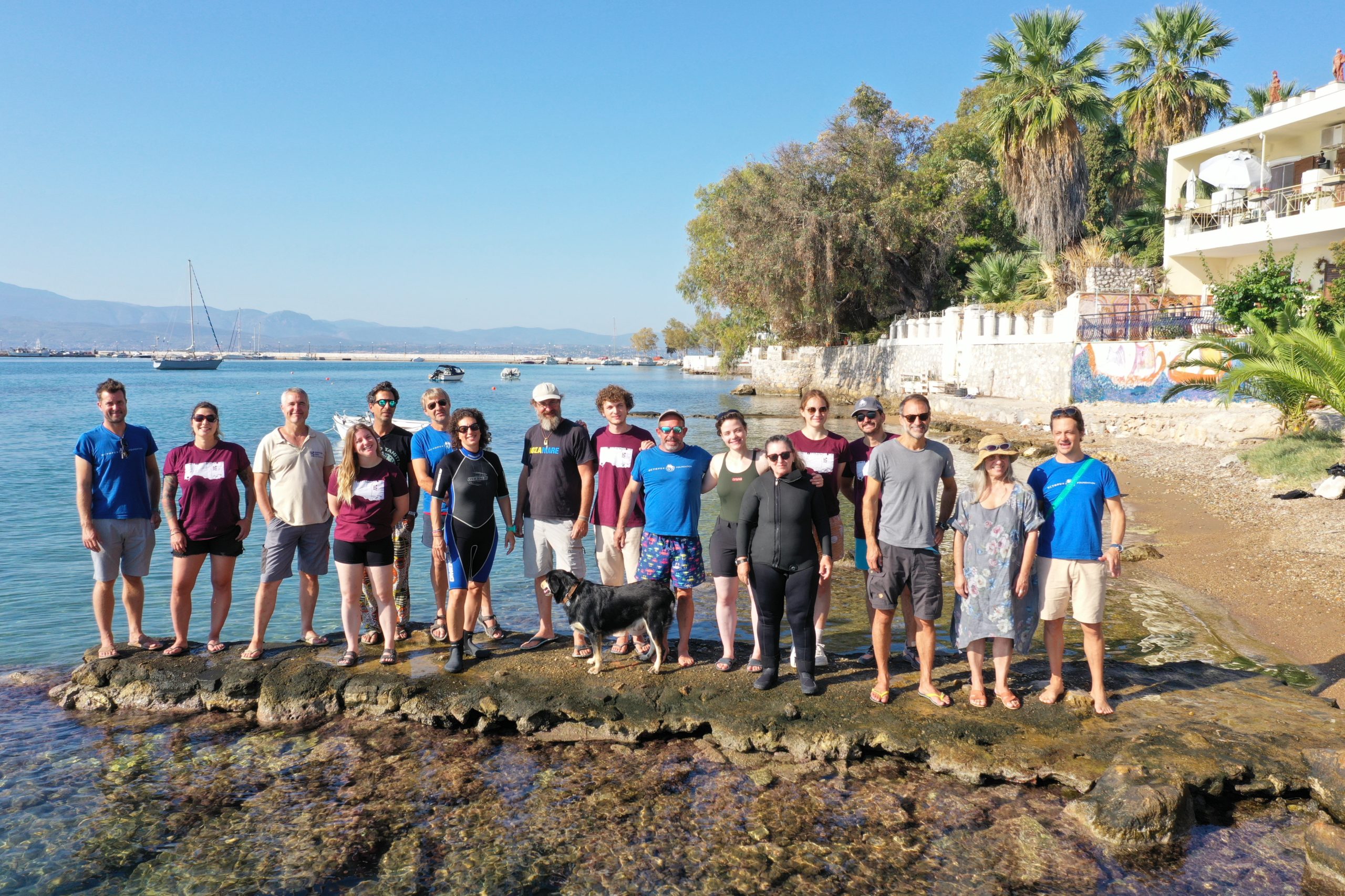
In 2025, the field mission which took place between August 31 and September 15 brought together a team of two divers from the Greek Ephorate of Underwater Antiquities, two archaeologists from ESAG, seven members of the Octopus Foundation (including five divers) and five students from Greek and Swiss universities.
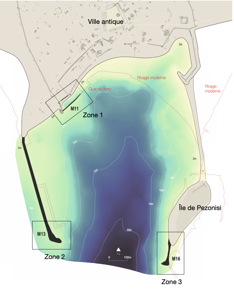
The main objective of this mission was to continue the excavation of the structures partially uncovered in 2024 and to precisely position them on the archaeological plan of the city. To this end, three zones were designated to carry out these initial investigations: The “commercial” zone in the immediate vicinity of the Southwest tower of the city fortification (Zone 1), the West breakwater of the port, now submerged and partially covered by the modern breakwater of the port (Zone 2), and the possible remains of the East breakwater, not yet found (Zone 3).
The second objective of the September 2025 mission was to evaluate the training of archaeology students within the framework of this project. The challenge lies in supervising archaeology students who must also have at least a basic diving certification (such as PADI Open Water or CMAS 1*). During the September 2025 mission, five students participated in the project: a Greek student from the University of Thessaloniki, a student from the University of Neuchâtel, and three students from the University of Lausanne. Ultimately, all the diving equipment, two boats, and a compressor (loaned by the Greek company Paramina) were transported by the Octopus Foundation team.
2024 campaign
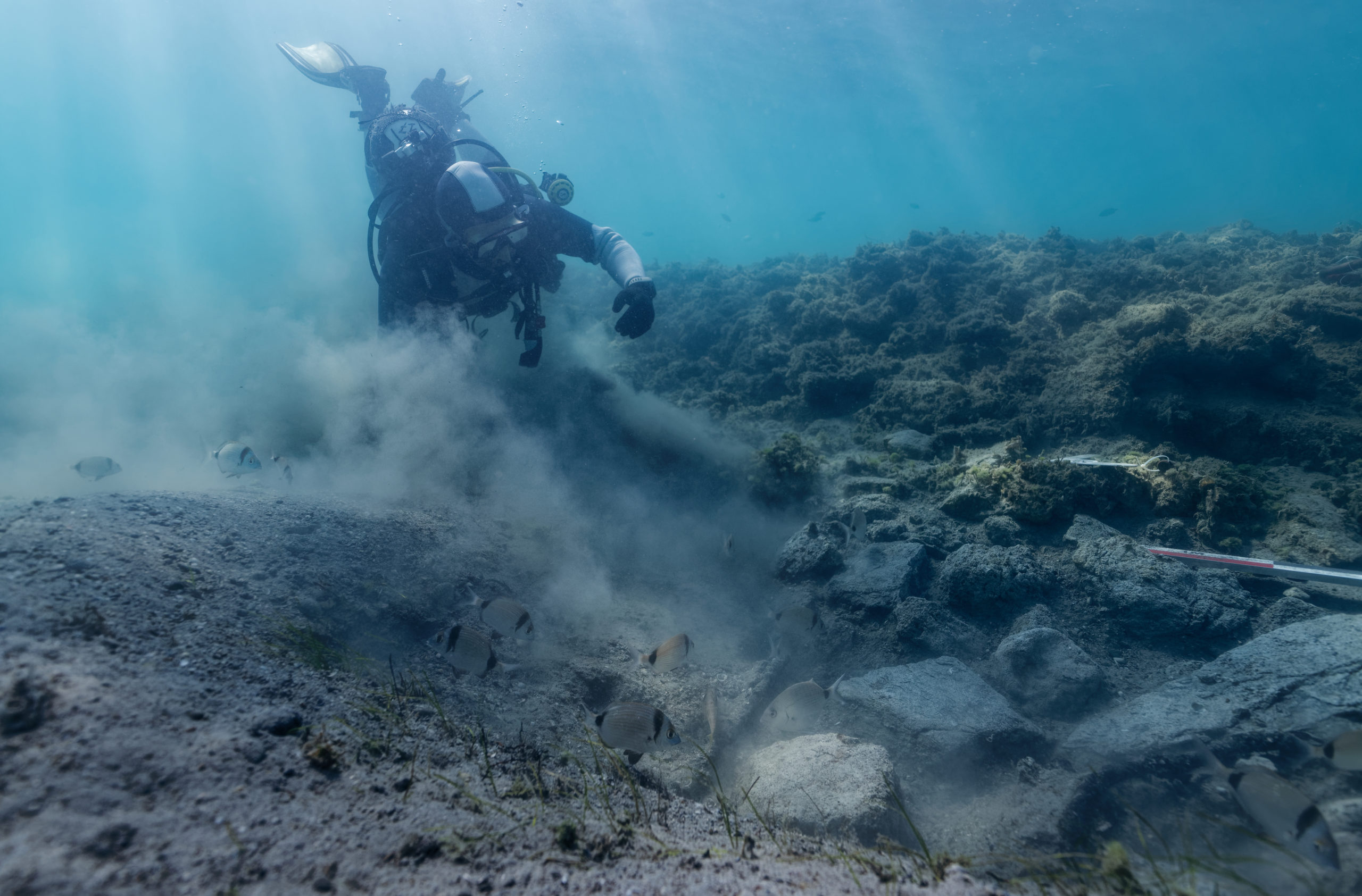
In 2024, the team of archaeologists and divers began cleaning the submerged outcropping structures located northwest of the port, in front of the beach, uncovering massive stone blocks type “wall” and “platform”- such structures that may have served as docks for ancient merchant ships. Considering the sea level rise of approximately 2 meters over the past 2,000 years, it is highly likely that the structures currently visible at a depth of about 2 meters were either above water or close to the shore.
Location
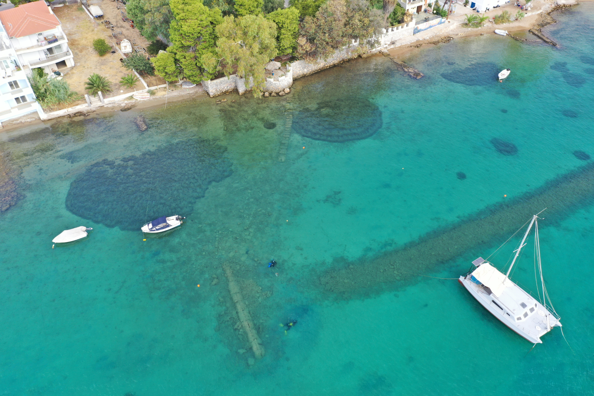
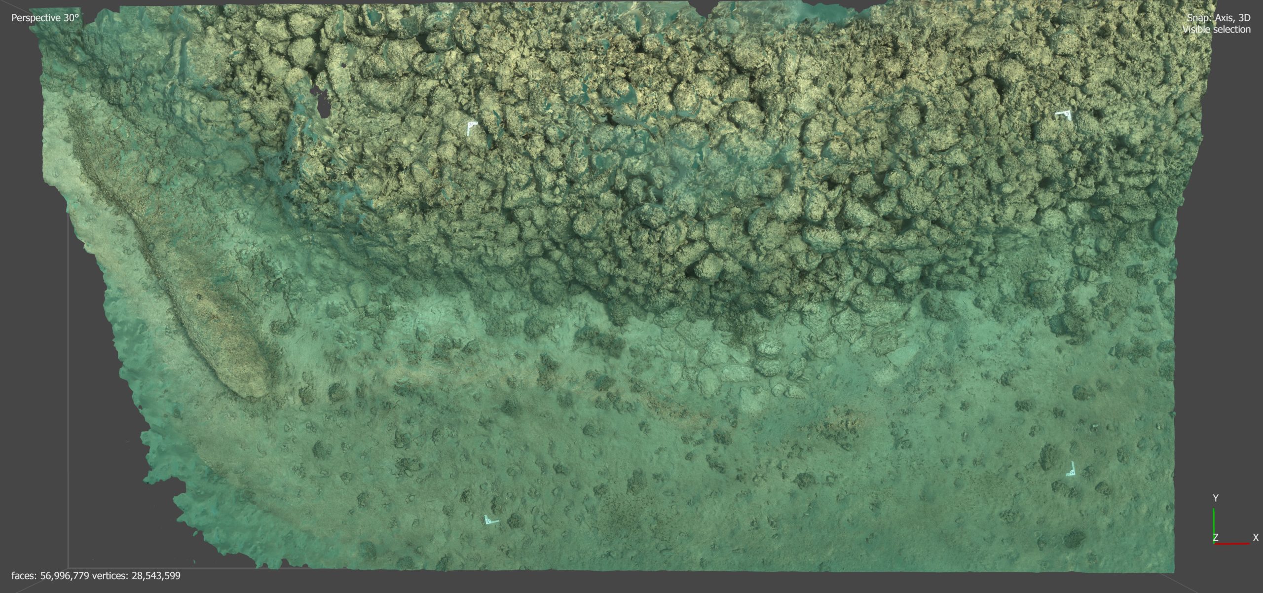
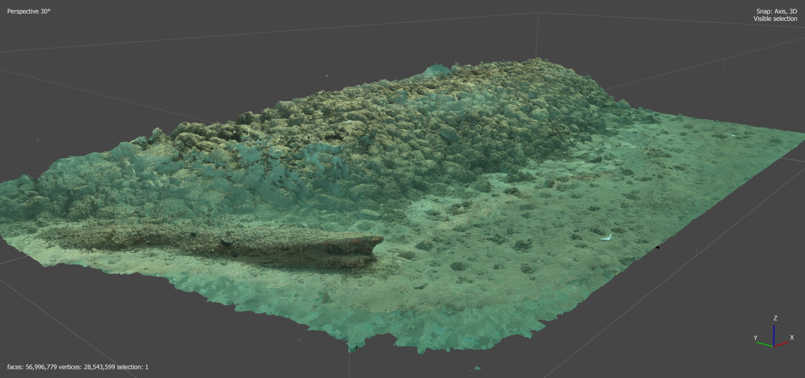
Underwater photogrammetry
Using various underwater cameras, divers take a series of photos at regular intervals across the entire area of interest. These images are then processed in a software to digitally reconstruct the area with high accuracy.
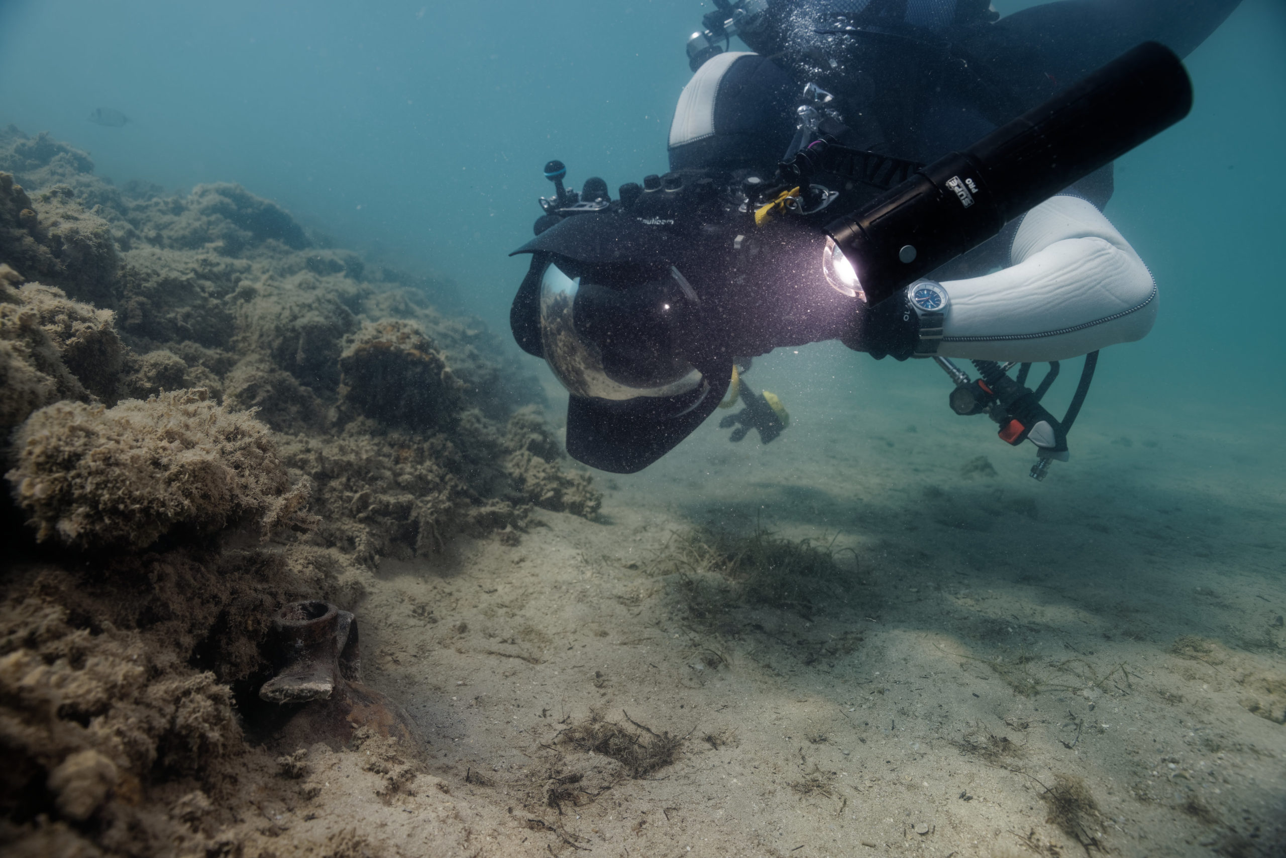 It is an important tool in the field of underwater archaeology. Indeed, specialists have a limited time of one or two hours to study submerged objects.
Photogrammetry makes it possible to study an area and sometimes to spot objects that had not been seen with the naked eye, whether for reasons of brightness or turbidity among others.
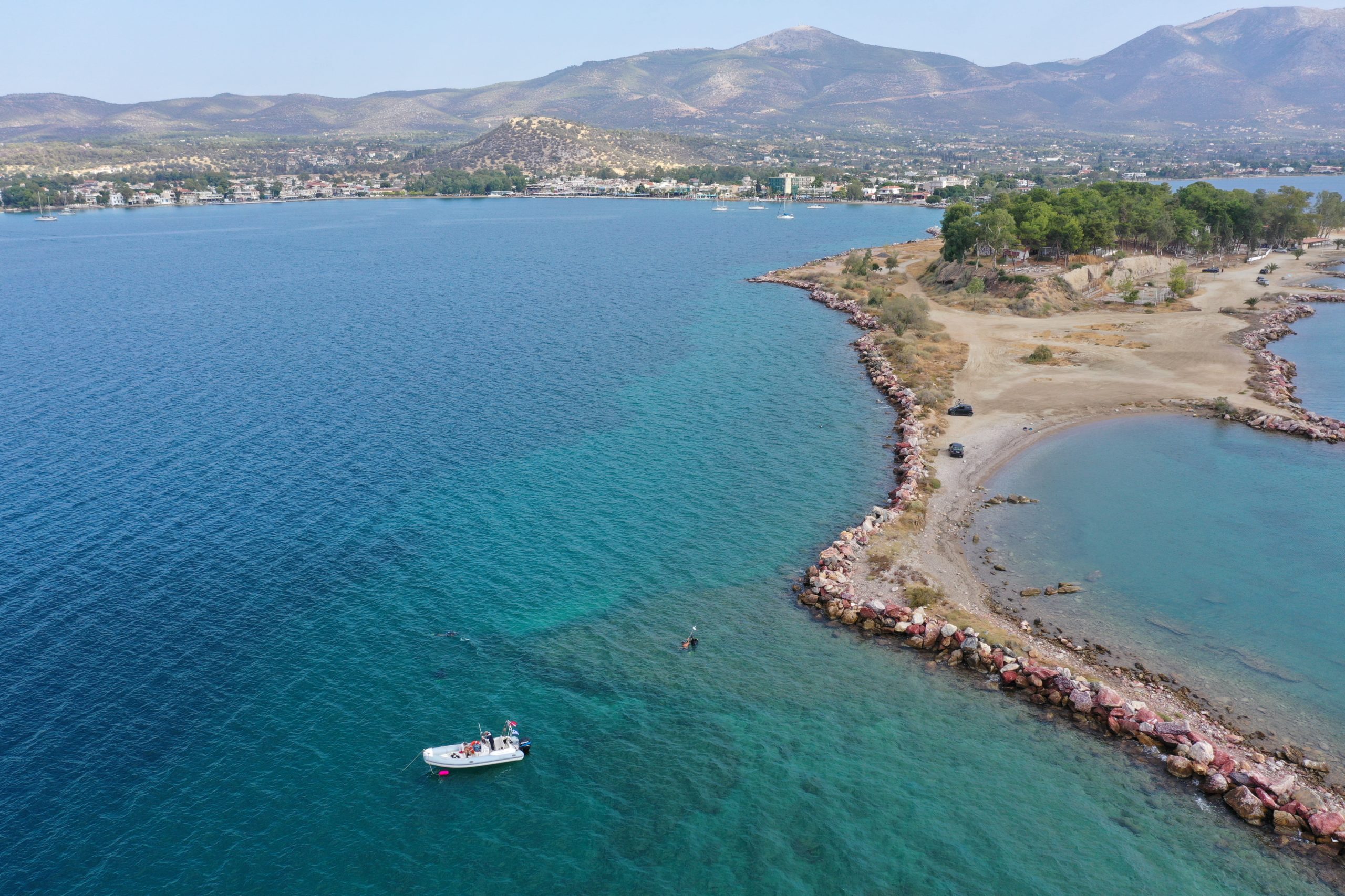
Aerial photogrammetry
 Thanks to the fleet of quadcopters equipped with photographic sensors, it is possible to cover a large area and gain altitude to obtain a different and enriching perspective.
With the advantage of water transparency, shallow archaeological elements can be studied and placed in a global context of ancient architecture.
Here too, photogrammetry obtained from a series of photographs is a scientific tool of major interest.
Autonomous boat, bathymetry and sonar
The use of a programmable boat allows, under certain conditions, for bathymetric and sonar data acquisition over a large area. The boat is equipped with a high-capacity battery, enabling it to operate silently for several hours.
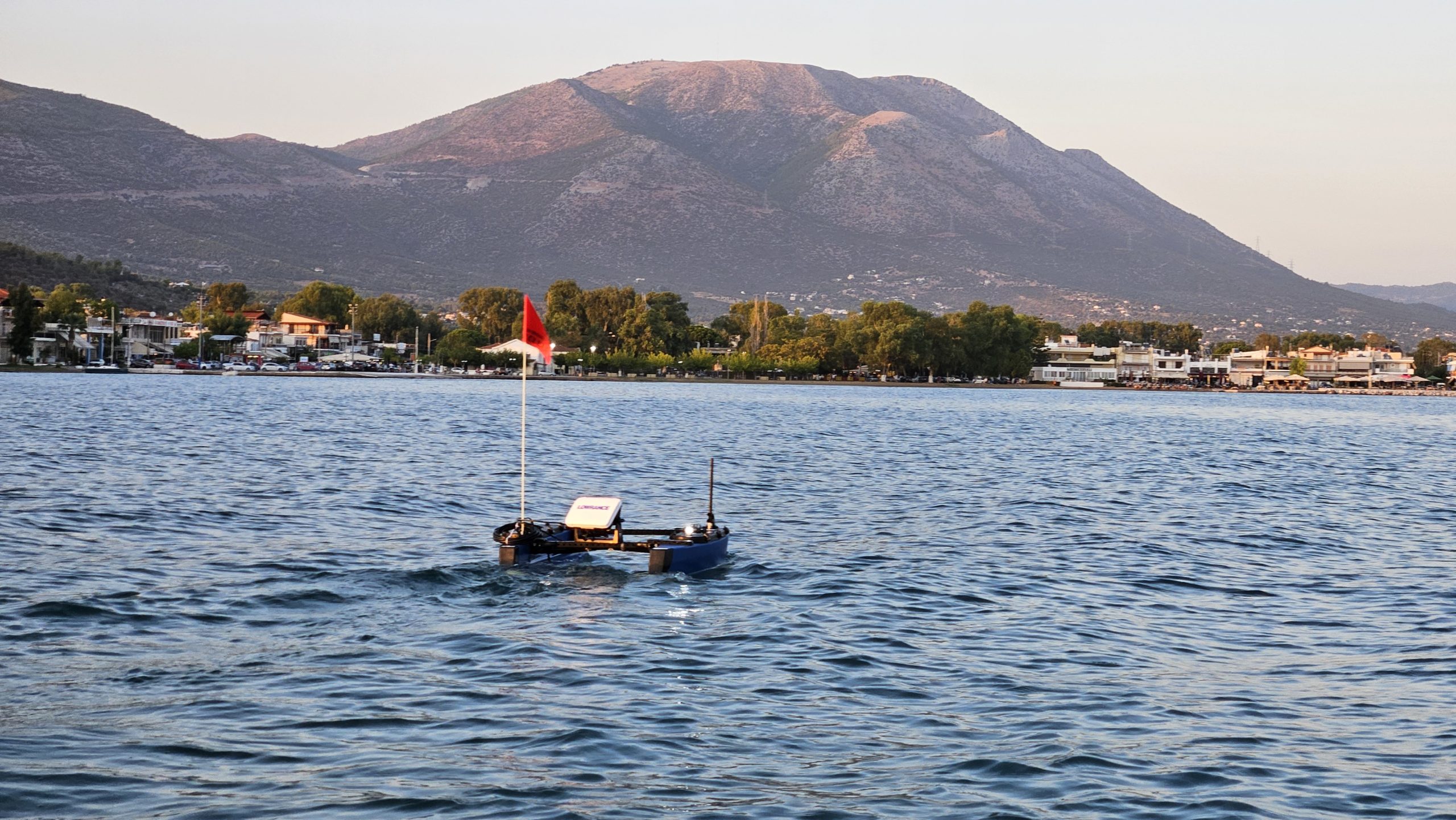 This model was developed in 2023 by the American company Blue Robotics, with whom we have collaborated for many years.
It is equipped with a transducer located 25 cm below the surface, and a Lowrance sonar that records data onto a microSD card.
Location
2025
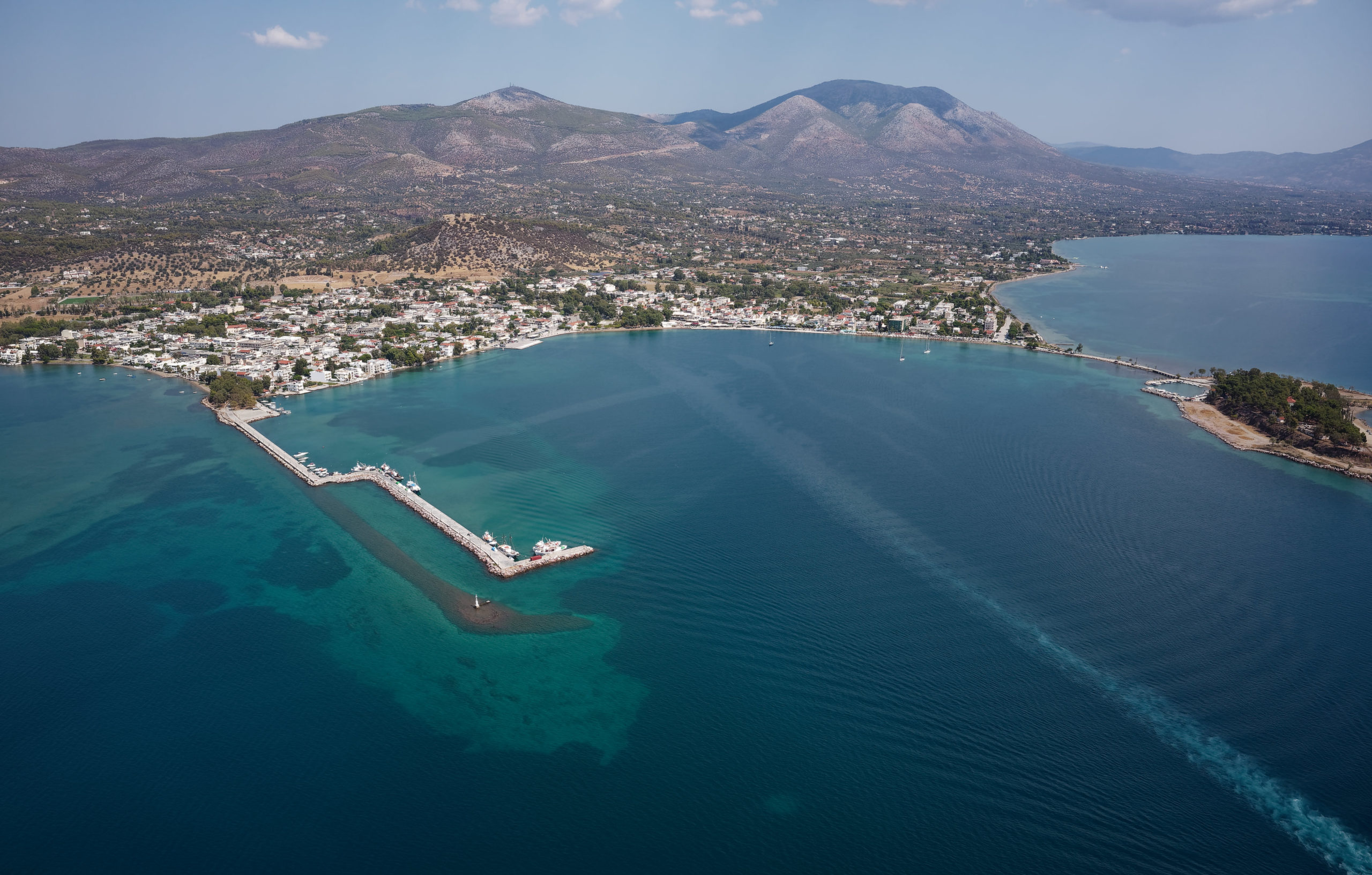
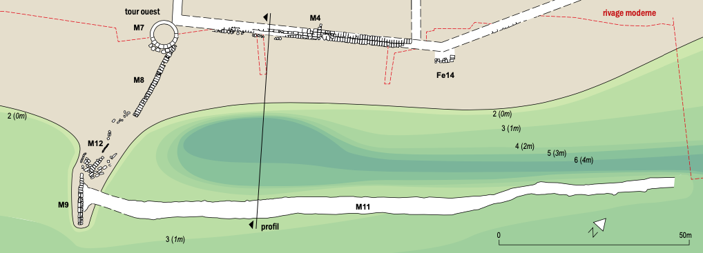
During the field mission of September 2025, the team continued the clearing of the “wall” and “platform” structures, a process begun in 2024. In Zone 1, near the last southwestern tower of the fortification wall, the team cleaned numerous stone blocks that could have served as a port platform for loading and unloading goods. This structure is adjacent to a breakwater approximately 150 meters long (M11 on the plan), parallel to the beach. During the mission, the hypothesis was put forward that this breakwater might have protected a small, calm port area where shallow-draft vessels loaded and unloaded goods. The team therefore conducted soundings in the sand with a thin, three-meter-long metal rod until it reached a hard surface, in order to measure the thickness of the sand that might have accumulated between the beach and the breakwater. Several profiles were measured and recorded. After analysis, the sand could have filled a small, old port area protected by the breakwater.
In Zone 2, the team conducted cleanups on the southernmost section of the large old breakwater (M13) to try to determine if a tower had been built there. Underwater 3D models were also created to study the structure’s profile, the type of stone used, and the construction method of this nearly 600-meter-long breakwater.
In Zone 3, the team conducted drone and diving surveys to try and find remains of the port’s eastern breakwater, which was originally built against the island of Pezonisi. We eventually located the southernmost tip of this breakwater (M16), curving inwards towards the port like its western counterpart (M13). Analysis revealed that this eastern breakwater, like the western one, was not only constructed on the hard surface of an ancient beach rock (fossilized beach), but it was also built with the same type of stone (similar typology).
Successes and difficulties
The 2025 mission is a success insofar as the expanded team (Ephorie of Underwater Antiquities, ESAG, Octopus Foundation and students, i.e. 18 people) managed to organize itself effectively to carry out two dives daily on three different sites, as well as teach several underwater modules for Greek and Swiss students (underwater excavations, underwater photography, underwater photogrammetry).
From an archaeological perspective, the 2025 mission has provided a better understanding of the structure of the ancient port of Eretria, by precisely positioning the two large western and eastern breakwaters, which protected an anchorage area of nearly 65 hectares for the ancient city’s merchant and military fleet. By continuing our research, we have also gained a better understanding of the area near the last tower of the city wall, which may have served as a protected area for merchant ships.
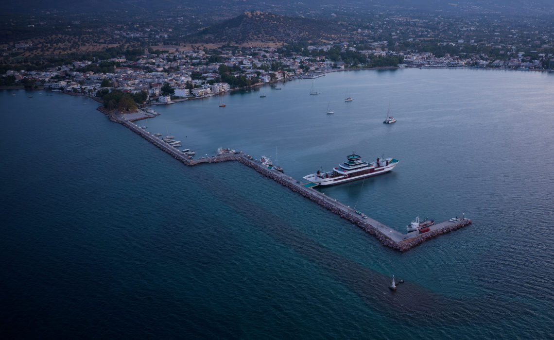
From the perspective of the challenges encountered, the proximity of this “commercial” area of the old port to the modern ferry terminal, which connects to the port of Oropos on the mainland, made us realize that significant construction work had taken place during the 20th century. Finding ancient remains there may prove difficult. Furthermore, access to this area by diving is complicated by the presence of ferries, which dock every 30 minutes during the month of September.
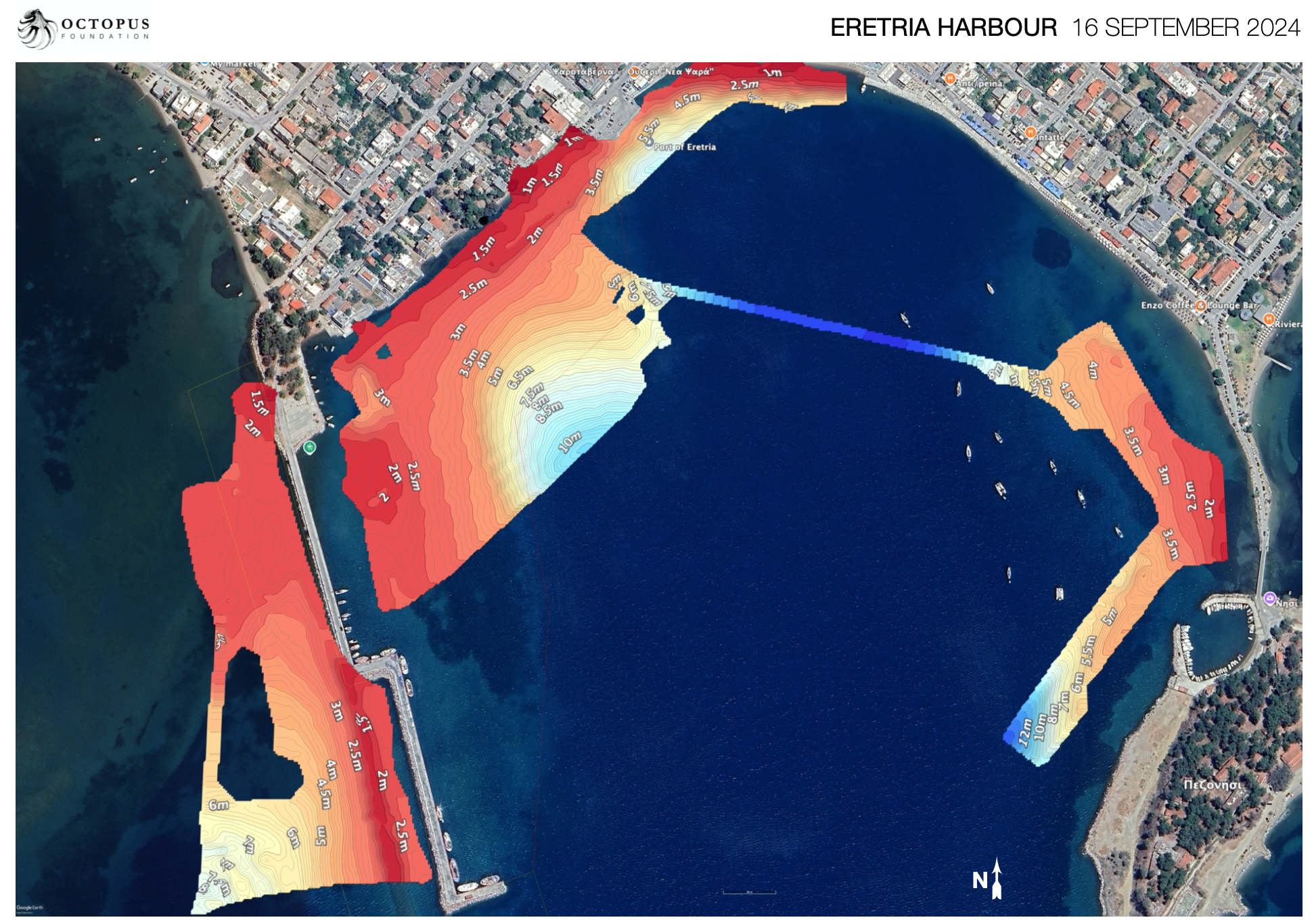
Bathymetric Survey 2025
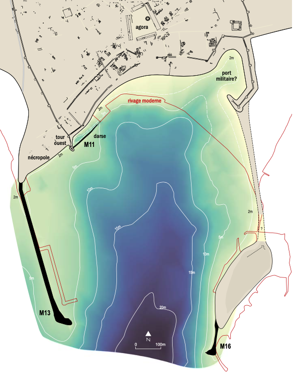
Maps of the remains 2025
Underwater photogrammetry 2025
For more information, please refer to the 2025 annual report of the Swiss School of Archaeology in Greece (ESAG).
Bathymetric Survey 2024
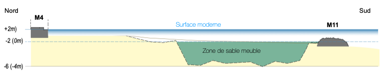
One of the main objectives of the 2024 campaign was to create a bathymetric model of the port. Using sonar mounted on a remotely operated vehicle, the seabed configuration was mapped. This work is essential for understanding ancient structures, because in the first millennium BCE, the sea level was approximately 2 meters below its current level. Consequently, structures now submerged to this depth were once built on dry land. Studying the underwater topography also allows for the repositioning of waterways and the identification of areas suitable for port facilities.
For more information, please refer to the 2024 annual report of the Swiss School of Archaeology in Greece (ESAG).
Location